Longs Peak - Keyhole Route (14,255 ft)
My friend Shari (one of my standard hiking pals) had hiked Longs a few times and knew that the best way to do it was to backpack in. This shaved off at least an hour of hiking in and out, and given that this was going to be a very long hike, it seemed like the right plan. Typically, if you backpack in, you have to camp on the Boulder Field just below the Keyhole (with a permit arranged ahead of time). Shari, however, knew of another campground - a group campsite called Battle Mountain, nestled just at treeline. Calling in March, she booked this site, which is capable of holding 12 people.
At one point, we had all 12 slots filled in our group, but by the time the date rolled around, we had our hiking party: my standard group of hiking pals (Brad, Shari, Lonny, and my wife Lisa) plus Alan and his son Joe. The plan was for Brad, Shari, Alan, and Joe to tackle the Loft route on Longs (since they'd all summited the Keyhole route before, and failed the Loft route once before), while Lonny, Lisa, and I would tackle the standard Keyhole route.
Day 1: Friday, August 11, 2006
Deferring to Shari's experience (as she'd done this at least twice before), we headed up to Rocky Mountain National Park in the early afternoon on Friday. Surprisingly, there was no park entrance fee to drive to the Longs Peak trailhead (of course, you can't get anywhere else in the park from there, except for hiking). As we approached the ranger station and the trailhead, we started seeing cars parked alongside the road as far as a mile out - obviously this was a popular hike (not that we were surprised by that). We pulled into the parking lot a little before 3pm, and surprisingly found a handful of parking spaces - by arriving just as most were leaving for the day, it made parking a breeze!
We spent some time exploring the ranger station, examining their scale model of the peak and looking at some of their museum pieces, and a photo album detailing the various routes (and what the approaches look like). There were people scattered around the outside of the trailhead, looking utterly exhausted - this trail obviously takes its toll on everyone who hikes it! We finally hit the trail at about 3:15pm, passing dozens of people heading down from the trail for the day.
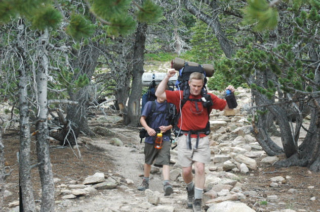
The trail wound gently up the mountain in a nice forest, finally breaking free of the forest about 2 miles from the trailhead. We were in no particular hurry to get to camp - Joe and Alan are both from sea level, so we kept a slow and steady pace. At 2.6 miles, we reached a fork in the trail and a stream crossing. To the left was the Longs Peak trail, and to the right, the Battle Mountain campground. We crossed the stream on a nice wooden bridge and headed into a grove of trees, pressing on for about another 0.3 miles until we reached camp (40.27N,-105.58W, 10,969ft), a little under 2 hours after setting out. I was a bit surprised by the camp site: sandy and smooth, nestled just below tree line and set back from the main trail, it was very nice. It was also far enough away from the stream we had crossed that the mosquitoes were not a problem - plus it had a pit toilet! That night, we enjoyed seeing the city lights of the Front Range and watching some of the Perseids meteor shower.
Day 2: Saturday, August 12, 2006
Lonny, Lisa, and I hadn't slept well - too concerned that we might sleep through our alarm. We had settled on getting up around 3:00am with the goal of starting on the trail at 4:00am (we had no misgivings that we'd be able to get ready that quickly that early). The morning was surprisingly warm, with a temperature around 50 degrees at camp. I was already anxious about tackling this mountain - today was the day!
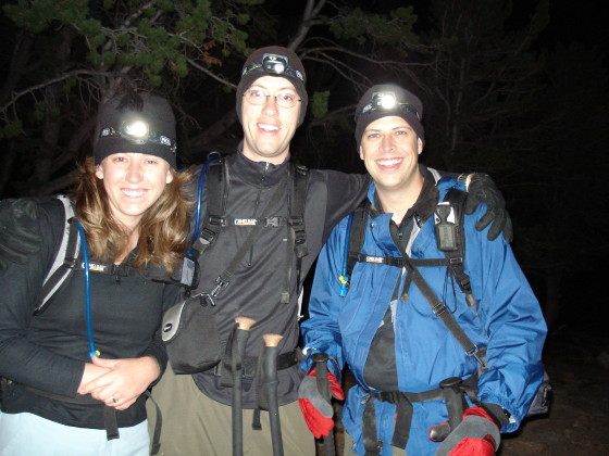
We managed to hit the trail at 4:00am. I was able to count at least six hiking groups scattered across the trail in front of us (based on the headlamps) - not too surprising given the popularity of this trail. We re-joined the standard trail that hiked up towards Mills Moraine (had we known about it, we probably would've taken a slightly more direct Jim's Grove trail that Roach's book describes, but we didn't discover that shortcut until later that evening). We started with a pretty fast pace given that the trail pitch was so gentle, passing more people on the trail before dark than I've ever even seen on most 14er hikes.
We reached Glacier Pass about an hour after setting out - the trail gently kept gaining altitude with rock steps, spaced a few hundred feet apart. Looking back eastward, the shape of the trail was clearly visible, outlined by literally hundreds of headlamps scattered across the meadow! The temperature gradually got colder and windier as we gained altitude, and between Glacier Pass and the Boulder Field, it seemed the chilliest. We encountered a handful of hikers in shorts that had really wished that they had brought some long pants - we had thrown on nearly every layer we had, but were staying sufficiently warm as we switchbacked up to the Boulder Field.
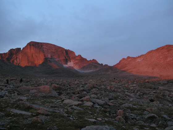
We reached the Boulder Field at 6:00am. The sun was rising at this point, so we stopped to take a few photos of the alpenglow off of the east face of Longs - suddenly the hour of our departure seemed worth it! A solid trail meandered through the flat Boulder Field up until we reached the camp area and privies a few minutes later. While camping in the Boulder Field had not sounded at all appealing to me, the sites that were laid out didn't look too bad - they had decent, level dirt floors, with rock wall wind shelters built up around them, plus marmot boxes to place food in. That said, I think I still preferred Battle Mountain (especially if there were lightning).
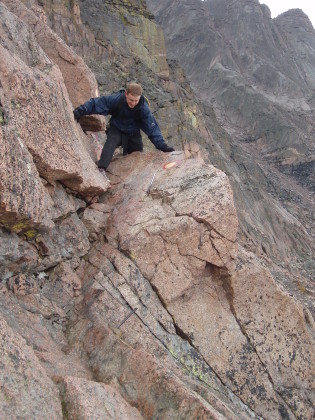
Past the camp area, the trail disappeared, and the pitch of the climb increased as we started to boulder hop up to the Keyhole, which we reached at about 7:30am. True to expectations, the view from the Keyhole was breathtaking (in more ways than one). Dropping down 2,000 feet below us was Glacier Gorge - a spectacular cirque carved in the surrounding rock. While beautiful, it took me a few minutes to accept the amount of drop that was ahead of me, and the fact that I had to hike along side of that drop. Glancing southwards to the trail, the red and yellow bulls eyes on the rock clearly marked the trail ahead, and it honestly didn't seem like it was going to be all that bad. I had to take a few minutes to acclimate to the idea, but after a short break we continued along the trail. (This section reminded me a bit of the traverse that we had done when we climbed Mt. Evans from Guanella Pass - the exposure and trail width seemed about the same as the final push on that summit.)
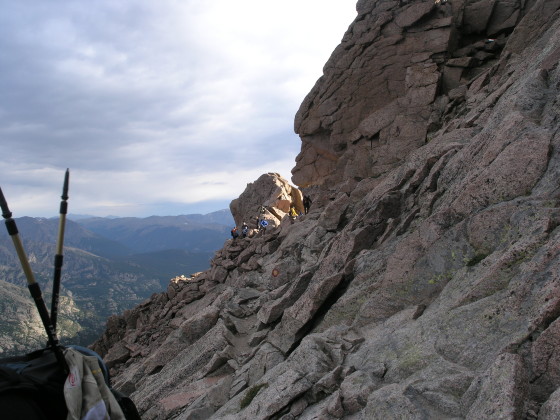
At first, I tended to the inside of the trail when I could, to nervous to get close to the edge of the rock that slanted steeply to the gorge below; but I found that, after hiking for a few minutes, I really started to relax and enjoy the hike. The rocks were not difficult to get around, and were actually kind of fun (aside from getting my hiking boot stuck twice, which is my own idiocy) - I began to explore the outer edges of the trail a bit more, gaining comfort in the elevation differential to my right.
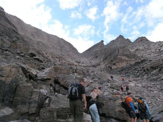
By 8:15am, we'd reached the Trough: a steep gully that allows you to gain about 600 feet. (Again, I was reminded of our ascent of Mt. Evans where we ascended a steep rock gully that was rather similar to the Trough.) The ascent was slow going: climbing steeply, I had to stop a few times to catch my breath. Their were some loose rocks along the ascent, dictating caution to ensure that we didn't knock any of them down on the hikers below (or that no one above us was doing the same). At the top of the Trough, we were presented an interesting challenge: a large boulder blocking the exit. Some people were going right around the boulder, but we had chosen to go left - it didn't really seem to matter, as it was an interesting challenge no matter which way you sliced it.
Of course, after working our way around the boulder, I was a little shaky. This was only exacerbated after we maneuvered through a small opening in the rocks and popped out onto the windy ledge of the Narrows, ratcheting my nerves to the highest point of the entire hike. It was about 9:00am, and the Narrows presented us with the most exposure along the entire trail. I had a brief moment of panic, but again found that, given a minute or so to relax, it wasn't all that bad. Anywhere that the ledge offered a lot of exposure, there were adequate handholds along the cliff face to easily guide any klutz through the difficulty. There were even occasional locations where the ledge widened enough to take a break or allow people to pass easily.
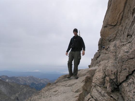
Just before the Homestretch, another challenging rock formation blocked passage. It wasn't an impossible rock to climb, it was just awkward, as no one could seem to get a good foot/hand hold combination to allow them to get over it quickly. This slowed traffic a bit, but no one really seemed to mind. Once past this obstacle, the Homestretch's smooth rock and parallel cracks popped into view. Lisa, who'd been a fine for the entire hike, started feeling a little uncomfortable, which just goes to show that everyone is affected by this hike differently - the Homestretch didn't worry me nearly as much as the Narrows did! It was now 9:30am, and we had 400 feet to go. We climbed the Homestretch slowly and deliberately, finally reaching the summit a little before 10:00am.
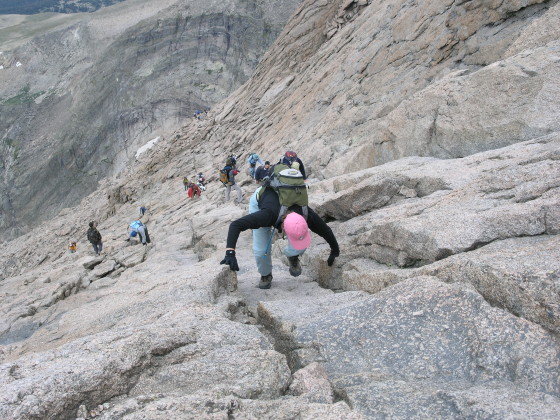
Throughout our ascent, we kept occasional radio contact with the other half of our party that was climbing the Loft route. Just before we reached the summit, we spotted them down low on the Homestretch, below where the Narrows joins. By 10:30am, they had joined us all on the summit, having left camp a full hour and a half after we had! We took a much needed break on the summit, keeping a wary eye on some nearby rain clouds.
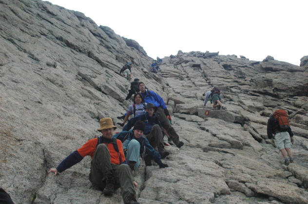
We began our descent a little after 11am - all of us were now going to head back through the Keyhole. As we started down the Homestretch, it started to sprinkle, causing the rock to become very slippery. We all downclimbed the Homestretch in kind of a crab walk - a few times I tried turning around to face the rock, but found that it was too hard to find good foot holds that way, and that the slick rock was harder to maneuver on.
We were back at the awkward rock on the Narrows by 11:30am - what in my mind divided the Narrows from the Homestretch, and then back to the top of the Trough 15 minutes later. The large chokestone at the top of the Trough was causing a large bottleneck, and it didn't help that it was now raining/snowing and visibility was reduced to about 5 feet. Shari was the farthest ahead in our party, had already gotten past the chokestone, and was now offering assistance to all the other climbers trying to get past it. It seemed that this helped a bit, having someone provide tips as to where to place your hands and feet. Meanwhile, most of our group, and many other hikers, were all lined up on the Narrows in the exposed rain just waiting for the chance to be on more solid ground.
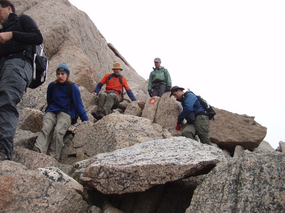
Once past the chokestone (which was a bit nerve wracking in the rain, but not terrible) the hike down the Trough was slow going. The wet rock often required us to use our hands to stabilize ourselves on our descent, almost reverting to the crabwalk of the Homestretch (a decent pair of gloves is highly recommended). We reached the bottom of the Trough by 1:00pm and stopped to take a break. It was 1:40pm by the time we made it back to the Keyhole, and back to the Boulder Field campsite by about 2:20pm.
We knew we had a long slog back to camp, but it was to be easy hiking compared to the terrain on the other side of the Keyhole. The only thing to look forward to here was the view from Mills Moraine (of the Loft, Meeker, and Longs) - other than that the trail just meanders down an alpine meadow, one step at a time.
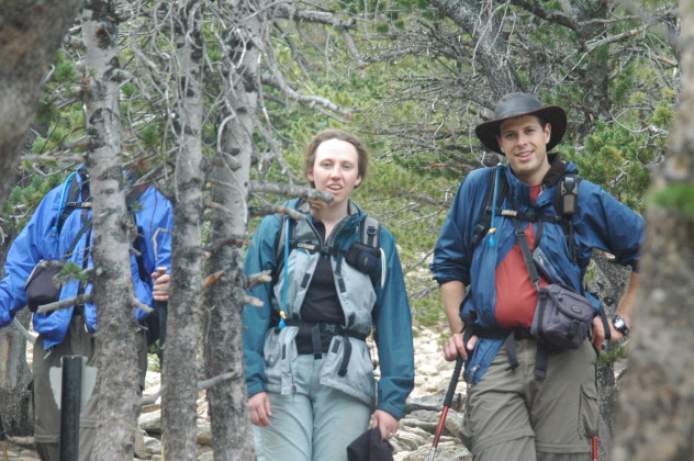
We finally rolled into camp around 4:45pm, nearly 13 hours after leaving. I'd heard that this was a long hike, and was prepared for it, but I can honestly say that I've never been so exhausted after completing a 14er. I've done other long hikes before, but 13 hours takes the cake. The shocking thing was that this was far shorter distance-wise than many hikes I've done in a day (Belford & Oxford, Pikes Peak). It was really the 1 mile stretch between the Keyhole and the summit that slows you down.
We went to bed early that night - between hiking for 13 hours and waking at 3am, we were pretty tired.
Day 3: Sunday, August 13, 2006
The next morning it took us a little over an hour to hike down to the trailhead, passing dozens of hikers heading up late in the morning.
I have to admit - I was very intimidated by Longs during the preparation for this hike. In retrospect, it doesn't really seem all the bad now (of course, all 14ers seem like that in hindsight) - certainly there is some exposure and slightly challenging class 3 moves, but the exposure is never without a solid footing or handhold. The margin for error may be thinner than on Grays or Torreys, but there is enough that at least I didn't feel too uncomfortable. I now believe it's more the fear of the unknown that caused my anxiousness. While I swore after returning to camp that I would never do Longs again, I've since reconsidered. It really was a fantastic peak, and now that I know what the exposure is like and how I react to it, I'd consider tackling this one again - or maybe even other Class 3 climbs.