Harry Gates Hut
My wife Lisa and I went on our first hut trip last year and had a blast. With a group of 14, we hiked to Margy's Hut, outside of Aspen. This year, the same group organizer (Tory) set up a hut trip to Harry Gates hut - not too far (as the crow flies) from Margy's Hut.
Tory's hut approach is not uncommon: rent out the entire hut (which holds 16) and carry enough food/alcohol so that the term "roughing it" never enters anyone's mind. First off, if you've never been to a 10th Mountain Division Hut Association hut, they're pretty posh for a backcountry hut - throw lots of food and beverage on top of it, and you've got a grand time.
Of course, that food has weight, but since no one is carrying tents, sleeping pads, cookware or stoves, their packs are considerably lighter than they would be if they were backpacking...that's where the food goes. Tory plans communal meals for the group. Everyone's on their own for lunch each day, but breakfast on the middle day is covered, as is dinner on both nights. He then divides the food up so each person carries a fair share of the food. The menu for this year was:
Saturday
Dinner: Caesar Salad, Spaghetti with sausage, garlic bread, boxed wine (mmmm...Franzia!)
Dessert: snow ice cream (snow, sweetened condensed milk, blueberries, chocolate syrup)
Sunday
Breakfast: Eggs, Pancakes, Sausage
Dinner: Chicken soft tacos with Spanish rice, Roy-Jitos (A Roy-Jito, named for its creator Roy Donehower, is a mixture of crystal light, Rum, and triple sec. This was a forced improvisation beverage, as the Rum margaritas we'd planned to make were thwarted by someone forgetting to bring up the limeade).
Dessert: Pineapple upside down cake (an elaborate mix of Bisquick, dehydrated pineapple, and brown sugar).
What goes in to cooking that for 15 people? Here's what we carried up: 3 lbs spaghetti, 20 sausages, 30 oz tomato paste (24 is probably sufficient), 4 loaves of bread, 4 bags of salad, 6 lbs chicken, 6 liters wine (boxed), 30 eggs, 3 lbs breakfast sausage, 1 box pancake mix, 24 oz syrup (12 oz may be enough), one carton butter (get two next time).
Why did I include all of that? Well, I felt that others may actually want ideas for what to bring or what to prepare, and, after all, it was part of the trip... but with that said, on to the real trip report!
For more information about the hut, check out these links: HutSki.com or Huts.org
Day 1: Saturday, January 31, 2009
We started our Harry Gates excursion from the Days Inn in Carbondale, where we stayed the night before. We drove out to the trailhead around 8:30am and arrived about an hour later.
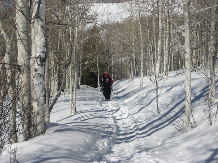
The turnoff was subtly marked with a small, blue, 10th Mountain Division Hut Association sign shortly before you reach the Diamond J ranch (we know, because we drove right past it the first time!) The parking area had room for probably 15 cars - nice and spacious.
We hit the trail a little before 10:00am in a bright, clear, blue sky day. Most of us started without our jackets on, and those that didn't quickly shed them a few hundred yards up the trail. With little fresh snow in recent days, the trail was already slightly packed down, and there were fresh ski tracks on it. The trail meandered through some private land to start off, until it reconnected back to the original trail about 3/4 of a mile east. Once it left the lower fields, the trail climbed steadily up switchbacks through a nice aspen forest, eventually yielding a nice view of the valley below where the trailhead lay.
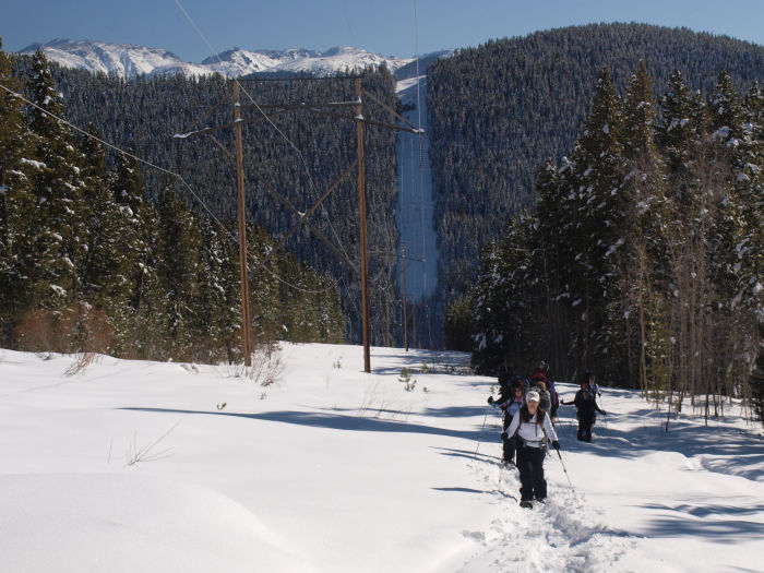
In the first mile and a half, the trail was the steepest, averaging about a 13% grade. Beyond that point, it entered a dense forest through Montgomery Flats, and the elevation gain abated.
We stopped for lunch about 2.5 miles up the trail, around 12:30pm. The sun was still very bright through the forest, so the temperature was quite nice. My pack thermometer read 50 degrees in the sun! After lunch, we continued on up the trail, eventually joining a road at 3 miles. I had read beforehand that this road may have heavy snowmobile use and was pleasantly surprised to see no snowmobile tracks. The road increased the grade of the trail a bit, but it was still far more pleasant than the initial ascent.
The trail was obvious to follow on the road, as it was already broken for us. We eventually encountered a set of power lines where the tracks left the road and followed the power line instead (3.7 miles). Looking at a map, the power lines created a small shortcut around one of the road's switchbacks, so we decided to follow the broken trail rather than the road. This increased the steepness for a quarter of a mile, but the advantage was that we didn't have to break trail. We intersected the road around 9,875 ft and continued to follow it instead of the power lines.
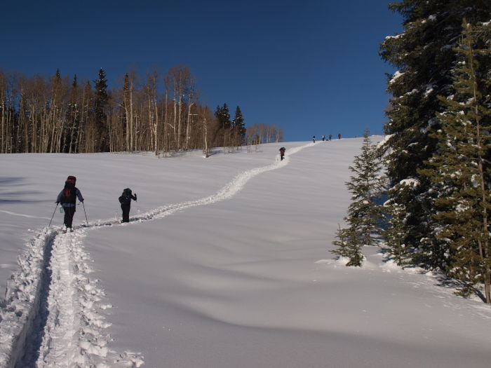
The trail began to level off at 10,035 ft, 4.3 miles up. We reached the spot around 1:45pm. As the trail contoured around the mountain, the view from the trail changed dramatically. From the top of the trail, we were still in forest, but the power line cut allowed a great view of the back side of nearby Mount Massive.
The next 1.6 miles was downhill in a more shaded section of the forest. Where the dense pine trees gave way to aspens, you could catch fleeting glances of Mount Sopris to the west, as we were now on the western flank of Burnt Mountain. The trail eventually dropped back down to 9,500 ft before taking a right turn up a steep hill for the last half mile. We made it to the base of this hill by 3:20pm.
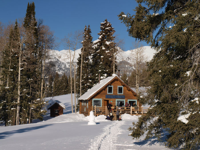
The last stretch up to the hike is a real leg burner. This hill, which affectionately became known to us as "Billy Goat Hill" (for reasons I won't explain...trust me) climbs up about 150 feet in about 0.25 miles. Normally, this wouldn't be too bad, but after hiking 6 miles in snowshoes, it'll wear you out. We all took comfort in the fact that, just on the other side of the hill, Harry Gates hut awaited. 15 minutes later, we had our snowshoes and packs off and the liquor out and were enjoying the fruits of our labor: a nice warm hut basking in the January sun.
Day 2: Sunday, February 1, 2009
Our second day at the hut led to various activities amongst my hut mates. Many chose to sit around and do nothing all day (by nothing, I mean knitting, reading, drinking, or all of the above). Some went off hiking on their own, but I went off with a small group (Chris, Kris, Roy, and Andy) to explore the nearby Lime Park area and its limestone cliff walls.
We decided to follow a broken trail northeast of the hut, which led us down through the forest on the north. The forest, at times, got a bit tight (I don't think I would've wanted to be on skis, like the trail we were following), but quickly broke through into a nice meadow at the base of Slim Jim Gulch. From here, our goal was to rejoin the road (that we followed for much of the hike in) around to Lime Park. We continued following a broken trail which joined up with the road a few hundred yards away. When we started, there were relatively few tracks back in this area, and the blanket of snow looked absolutely beautiful with a rugged backdrop of Avalanche and Eagle peak to the east.
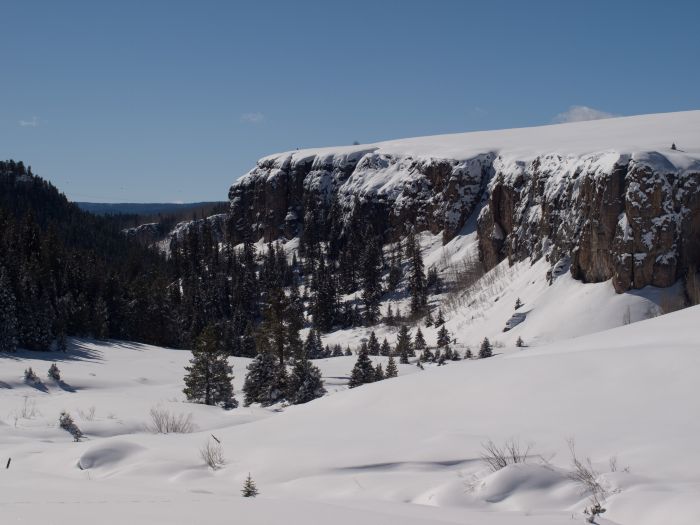
As we got closer to Lime Park, the whine of snowmobiles was much more prevalent. Through the trees, we could see snowmobile trails all over the mountain to the west. A fallen tree on the road had seemingly stopped their advance back into the valley we hiked out of (but was easily stepped over on snowshoes).
Lime Park was a wide open, snow covered meadow that dropped quickly down into Lime Creek Canyon. We hiked down, still following the road, to the mouth of the canyon. Two snowmobilers past us and descended into the opening of the canyon, exploring down a tad further. After exploring a little, we began to hike back out, opting to follow the nicely packed trail left by the snowmobiles. They had gone up the road to the fallen tree and, as we hiked out, managed to clear the tree out of the road.
Rather than follow our forest trail back up to the hut (which was pretty steep), we opted to follow the road back around to Billy Goat Hill. Instead, we encountered a small sign indicating that Harry Gates hut was to the left, so we opted to follow that instead. This route was some sort of a service road, as it climbed gently up the hill to the hut, approaching from the west. Our leisurely hike lasted about 2 hours.
Day 3: Monday, February 2, 2009
After eating breakfast, packing up, and cleaning the hut, the group hit the trail in waves. The skiers (Brian and Chris) hit the trail first, as Chris was concerned that his binding repair may not hold for his descent (his binding broke on the way up, and he made a very ghetto repair involving splinters of wood and duct tape for his descent).
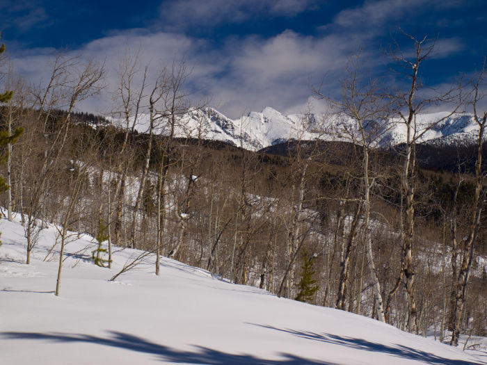
The girls left next, leaving Lisa, Andy, Carlos, Kris, Tory and I to leave last, around 9:30am. It was another clear blue sky Colorado morning and Carlos even opted to hike out in shorts!
The group made pretty good time on the hike out. It was a bit brisker than the hike in, largely because we started at a higher elevation and a bit earlier, but the day quickly warmed up. I took my time on the hike out, venturing off the trail to take photos a few times. We made it back to the car around 12:30pm, three hours later.
Everyone had largely dispersed from the trailhead already with the plan to rendezvous at the Glenwood Springs Brewery for a late lunch. Afterwards, one car hit the Yampa steam caves, while Tory, Lisa and I relaxed in Glenwood Hot Springs.