Trip Report Not Yet Available - maps and GPX files can be found below.
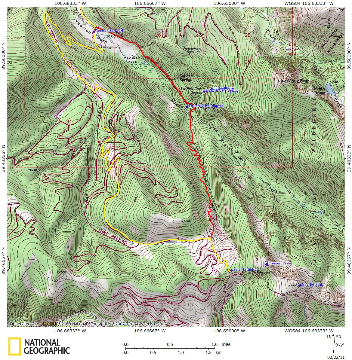
4/2/2011Peter Estin Hut Date Hiked:4/2/2011Location:EagleRange:SawatchTrailhead:Yeoman ParkDistance:4 milesAltitude:2609 ftDuration:4.5 hours ski up, 2.3 hours ski downCoordinates:39.465N, 106.650WLast Updated:4/2/2011Trip Report Not Yet Available - maps and GPX files can be found below.Maps and GPS DataGPX Waypoint File Google Earth KMZ File PNG Topo Map Share on Facebook Share on X Share on Pinterest Share on Bluesky Buy me a coffee