Maroon Bells-Snowmass Wilderness 4-Pass Loop
A good friend of mine had suggested this hike to me the year before - she had read about it in one of John Fielder's hiking guides. At the time, it seemed like an insane idea, but gradually I warmed to it. Over the winter, we started to consider it more, and by Spring, 5 of us were committed to it.
The plan was to do it in the beginning of end of July/beginning of August. The trek consisted of a start at Maroon Lake, over West Maroon Pass, Frigid Air Pass, Trail Rider Pass, and Buckskin Pass, and then back to Maroon Lake. We'd do this in 4-6 days, depending on how we felt, and whether or not we had decided to try summiting Snowmass Mountain.
In the end, it took us 4 days to do the trek (full 8-9 hours of hiking a day), and presented us with the most spectacular views I've ever seen.
Day 1: Saturday, July 30, 2005
We got off to a late start at the trailhead – lunch in Glenwood Springs (plus our estimated time of arrival to the city) took a little longer than we had expected. We set off from Maroon Lake at about 2:30pm. Since there were 5 of us (Brad and Shari, Lisa and Brian, and Lonny) all going our separate ways after the hike, we ended up traveling to Aspen (from Denver) in three separate cars. Lonny and I left our cars at the Maroon Bells shuttle parking garage (albeit illegally, we weren't towed) and we all piled in Brad and Shari's Land Rover to trek up to the trailhead; we didn't see the need in taking up three spaces at the trailhead.
As we set out, we ran into dozens of tourists at Maroon Lake, pretty much just as we'd expected to see. Once we were past the lake and ascending towards Crater Lake, we must have passed at least 50 people hiking back from the lake. As an ominous sign of things to come, about ½ mile out from the lake we hear thunder in the distance – far enough not to be too concerned, but close enough to make you wary in the mountains. Thankfully, we were pretty much in tree cover most of the time, and the rain managed to hold out for some time.
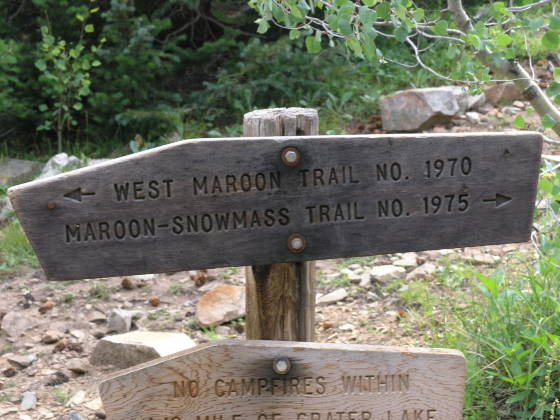
Just before the lake, we arrived at the sign indicating the start of our loop: to the left was West Maroon Pass, to the right, Buckskin Pass. Since Shari chose the route, we had decided to go over West Maroon first. We crossed paths with two other parties along our trek that did the loop in the opposite direction…I'm not sure it makes much difference. Anyway, at the sign, we ran into another group of 5 hikers: two from Boulder (husband and wife) and three men from London. They were also doing the loop in the same direction we were. We chatted a bit and headed off around Crater Lake, confident that we would continue to see these folks along the trail from time to time.
Ascending up from Crater Lake, we wandered through some tall riparian plants and talus from Maroon Peak. All in all, the hiking wasn't bad. Our goal was to get as far as possible on Day 1 as possible, as the following day we'd have to crest West Maroon and Frigid Air Pass, and according to the topo map, about 7.5 miles. Nominally, the most I thought we could cover on Day 1 was about 5 miles before we hit tree line, our last vestige of shelter from lightening (feeble, as it may be). We hiked past a number of marked campsites near Crater Lake, most of them occupied, and pressed on, gaining more and more elevation. Brad at one point questioned whether or not we'd re-enter tree cover, but eventually the gaining broke and the trees re-appeared. Of course, so did our first stream crossing.
Just below Maroon Peak, we had to cross West Maroon Creek. I had read another internet trip report that mentioned the stream crossings, so four of us brought sandals with us, but thankfully there was a large snowfield still in place over the upper part of the creek. It was very solid, so we just wandered over it, rejoining the trail a little higher up, sparing us the time to take off our boots. The stream was probably about 50 feet wide and maybe a foot deep – nothing too major.
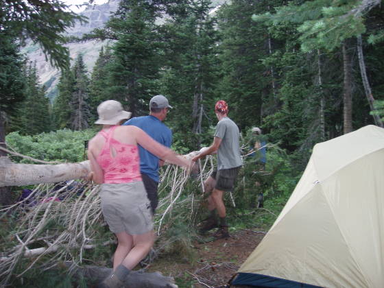
After some searching, we eventually located a great campsite high above the creek below (for those that are GPS enabled, 39º03.604'N, 106 º58.401'W). Brad organized all of us to move some felled trees out of the way of a nice group area to spruce it up a bit. We pitched our tents and started to unpack our gear when the storm that we had heard earlier finally caught up to us. It sounded as thought the thunder was one or two valleys away, but was traveling directly over our valley…an odd sound through those basins!
Brad, Shari, and Lonny all hung out in the shelter of the pine trees, while Lisa and I took a nap in our tent. Just about an hour later, the gentle rain let up, and we all had dinner. The mosquitoes were not too bad at this site (which can't be said for our later camps) and we ended up having a regular deer visitor to our campsite, about 50 feet away!
Day 2: Sunday, July 31, 2005
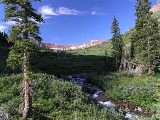
We had decided the night before to get up when we got up…which ended up being around 7am. By the time we ate and broke camp, it was about 9:00am, with clear blue skies and warm sun. Within about 20 minutes of hiking, we encountered our second stream crossing (again, West Maroon Creek). There was a bit of a false trail heading up river on our side of the stream, and a man was wandering back down it, indicating that there was really no better crossing than this one (apparently, the other backpacking party wandered too far down this and ended up off course a bit, according to some other travelers along the trail). We threw on our Tevas (except Brad, who went barefoot—slowly) and crossed the chilly 40º waters…what a way to wake up! The stream was pretty narrow, maybe 10 feet wide, and probably no more than 1 foot deep at our crossing.
Once our boots were back on on the other side, we pressed on up the trail towards West Maroon Pass. Gradually ascending and veering west (to the right) we finally caught sight of the passes summit.

In the meantime, we had been passed by a handful of hikers in the daypacks. Perplexed, we finally stopped one of them to find out where they were headed. Apparently, this route was a popular one to hike from Aspen to Crested Butte, heading from Maroon Lakes up over West Maroon Pass down into Schofield Pass, where Crested Butte is a mere 10 miles away.
We hit the final stretch of West Maroon Pass, a long upward sweep up the side of the ridge and hit the summit around noon. To my surprise, there were close to 30 people on top of the tiny summit, almost all of them day hikers, with the exception of the other 5 backpackers on the same journey as us!
The top of the pass was crowded, but the view was spectacular. From this vantage point, we couldn't see Frigid Air Pass but I knew it wasn't too far around to the right. From here, it was clear that the area between West Maroon Pass and Frigid Air Pass
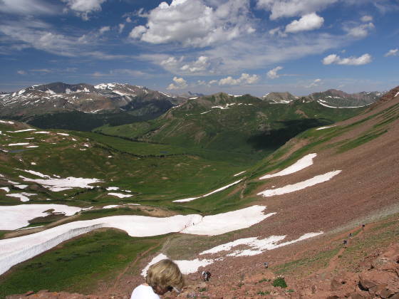
wouldn't offer much shelter from a storm if need be, as we'd have to lose a lot of altitude to regain tree line. The other group of backpackers had thought we were nuts to do both passes in one day, but after seeing the basin and the billowing storm clouds building to the east, they reconsidered and decided to press on over Frigid Air pass as well.
As we hiked through the East Fork valley, we leap-frogged the other group, as we were faster hikers than 3 of them, but took more rest stops. The closer we got to Frigid Air Pass (which Lonny occasionally referred to as Maytag Pass), the more spectacular the wild flowers became. I've never seen such a beautiful hillside covered in mountain wildflowers…this is certainly the Colorado the tourism board wants you to know about!
As we reached the “end” of the valley, our hopes sank a little as we realized that the pass wasn't the low point on the ridge straight ahead
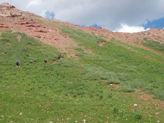
of us (which would've taken us into the Hasley Basin), but rather directly up the ridge on our right (this became obvious once I saw someone moving up on the pass summit). The last push to the summit was very steep, ascending up the even steeper hillside – Brad made the statement later that he thinks that's the steepest pitch he's hiked with a pack on…it was pretty brutal, but thankfully fairly short. According to the other hiking party (that had stopped for lunch at the base of the final push), it took us about 17 minutes to accomplish the last push up the pass.
The ascent was rough (nearly a 30% grade), however the reward was well worth it – as we crested the pass, Maroon Peak just appeared into view, dropping over 4000 feet straight down in the lush green Fravert Basin below. This was probably the most spectacular view of the whole hike, perhaps just because of the way it reveals itself to you so suddenly! We topped the second pass around 2:30pm.
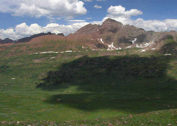
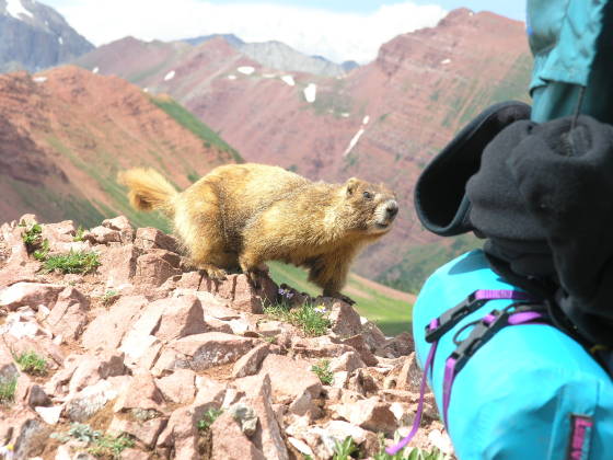
At the summit, we gave ourselves a much need rest from the ascent and had a snack. Within a few minutes, we were surrounded by about 6 marmots, all curiously watching us, some even coming in for closer inspection. The summit also afforded us a nice view of Snowmass Peak and Snowmass Mountain, the latter which we were potentially considering to ascend, but it also gave us clear direction of where we went next (aside from down).
We started back down a large number of sweeping switchbacks down into the basin. Clouds continued to puff up to our east, but we were not too far from the Spruce and Fir tree coverage in the valley floor.
Again, our goal was to cover as much ground as possible prior to stopping for the day, simply to gain on the following day, however we'd already covered a LOT of ground (close to 8 miles already). From
the other trip post I'd read, it seemed best to hit the next stream crossing, and camp on the other side, which still meant we had another 400 feet to drop.
The deeper we got into the trees, the more our bug spray came out. Mosquitoes started to become more of a nuisance, although not bad while moving. We eventually came to the valley drop-off, which was next to a giant 400 ft waterfall that dropped down below. Above the fall, there were two or three decent campsites, but we chose to press on instead. We switchbacked through a heavily wooded area down to the valley floor below, wandering across a few good campsites, unfortunately they had a lot of horse manure in them, making them less desirable than most.
We kept moving, crossing a small stream by rock-hopping, and continued to look for decent campsites not covered in horse manure (which posed a problem in most of the locales we spotted). Of course, by now, the storm had reached us and thunder echoed through the valley as rain started to fall around 5:30pm.

We eventually stumbled across some outfitters camp with two large canvas tents (with cots!) along with dozens of meandering social trails (this explained all the horse manure). We were sure that one of these trails was ours, so we continued to explore, eventually dead-ending all of them. As the rain continued to fall, we backtracked back to the first site we had found, and in the process saw the original trail fork that we had missed (I emailed the Aspen Ranger District…hopefully they'll put a sign up at the fork).
In the rain, a campsite with some horse manure seemed better than wandering around after 9.5 miles of hiking, so I grabbed a tree branch, swept out the debris, and we quickly pitched our tents in the rain and
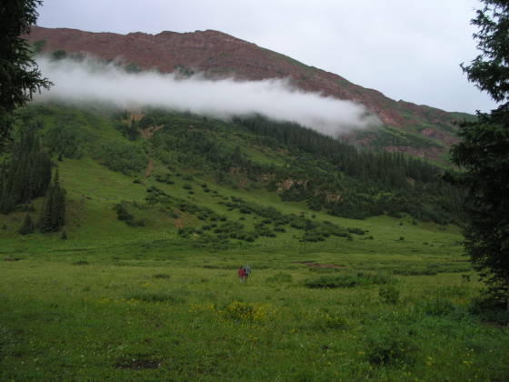
lightning around 6pm (there's nothing quite like holding long metal tent poles in an electrical storm at 10,400 feet, is there?). The site (39°04.947'N, 107°02.463'W) was in a small isolated stand of trees in the middle of the valley, close to the trail (nothing could help that) that would at least provide a little shelter from the storm.
Once again, about an hour later the rain let up. Lonny wandered down the other fork in the trail (the correct one, to the right) and discovered that we were maybe 200 yards from the stream crossing I'd read of, so we shouldn't even bother with hiking boots in the morning. We pumped water, spotted an elk, made dinner, and headed to bed. Just before bedtime, the clouds parted and the brilliantly starry sky made itself visible for the first time on our trip. Brad had made a comment at dinner that he'd checked the internet to see if the shuttle Discovery (on its maiden voyage in 2 years) was flying over while we were out…it wasn't.
Day 3: Monday, August 1, 2005
Waking up around 7am again, we got a faster start than the day before, ready to depart around 8:30am. Just as we were heading out, our “hiking buddies” wandered down the trail. They had camped up above the waterfall the night before (and obviously got up earlier than us). We followed them down to the North Fork stream crossing. This river was maybe 20 feet wide, and anywhere from 1.5 to 4 feet deep, depending on where you chose to cross it. Lonny decided that he needed a bit of a rinse, so after depositing his pack on the opposite bank, he proceeded back into the frigid water and sat down in the middle of it. I suppose that's one way to wake up in the morning.
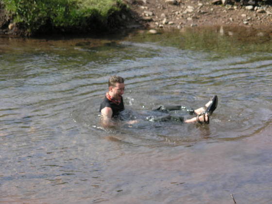
Once most of us had finished drying our feet (Lonny had a lot more drying to do), we started up the trail about 9:45am. It meandered pleasantly through wildflowers, willows, and dark forests. I did note that there didn't seem to be many great campsites along this side of the river (but I wasn't looking too hard), so I was glad we stopped when we did the day before.
The pleasant trail eventually gave way to some fairly steep switchbacks that just shot up the steep valley wall. While a slow and steady pace got you up them, looking down the grassy slope to the side of the trail made me appreciate balance…I wouldn't want to fall over here, as it'd be a nice long tumble down the hillside. Although, on the plus side, the views were, again, spectacular.
After climbing about 1800 feet up the valley wall in about 3.5 miles, we stopped for a break around 11am (at the splitoff of the trail to Geneva Lake). We knew we had another 300 foot push, a brief reprieve, than a final 800 foot push to the top of Trail Rider pass. Once we resumed and hit the first 300 foot gain, we were rewarded with another spectacular view of the Fravert Basin and Maroon Peak, as well as a glimpse of the top of Trail Rider Pass. Our friends had stopped by a small pond up at this resting place for lunch. We chatted a little more, then continued our push up the pass, this time timing ourselves.

From the pond to the top, it took us just about 45 minutes. This last bit wasn't as steep as Frigid Air Pass, but it still had a good deal of grade to it (800 feet in just under ¾ mile = 21% grade!). The pass had three switchbacks to it…one long sweep up the valley wall, and then two short legs near the end. The trail was pretty solid until the last two switchbacks, at which point the trail became faint (meaning it had washed away a bit) where it cut across a steep slope of scree which was fairly loose under foot. I was thankful I had poles, as a slip here could send you down for a nasty ride. It was a little dicey, but there was probably a lot of room for error. We crested the summit around 1:15pm. Up top, we encountered two other backpackers that had started from Snowmass Village and were on their way to do Capitol Peak, which was a stones throw from our present location.
From the summit, we had a nice view down to Snowmass Lake (Snowmass Mountain was no longer visible), and we started to descend around 1:45pm. There was certainly much more snow on this side of the pass, but none of it was very problematic (it didn't cross the trail very much). The trail made long switchbacks down the grassy slope, eventually leading to a more rocky hillside as we started to hike around Snowmass Lake. I was honestly a little surprised at how long it took us to get down the pass, as our ultimate destination (Snowmass Lake) had really appeared rather close from the top of the pass.
We wended our way down until we encountered the split in the trail, with one side heading towards Buckskin Pass, the other to Snowmass Lake. We forked to the left and headed to the lake, arriving at its shores a little after 3pm. There were a few campsites right there, but one or two were occupied, and many had been marked as a NO CAMPING spot by the Forest Service (too close to the lake). We crossed over the stream exiting the lake on a log bridge and meandered more along the northeastern shores of the lake. On this side of the stream, there were a dozen or so good sites (and even more if you wandered farther from the lake), so we picked one and set up camp.
It was a nice treat to arrive so early at our campsite…we had beat the rain by at least 2 hours! To celebrate, we pitched our tents, and took a little dip in the lake. It was very brisk 60 degrees that most of us couldn't tolerate for very long, but it felt quite refreshing. After our dip, we pumped some water, made dinner, and, as if on cue, a storm rolled in right around 5pm. We ate in our tents for the hour of rain, at which point it subsided and we emerged. The mosquitoes at the lake were, not surprisingly, the worst of the trip – a nuisance, but still not as bad as we saw them in Holy Cross Wilderness.
Day 4: Tuesday, August 2, 2005
Our original trip plan included summiting Snowmass Mountain on Day 4, however Lonny had cut his toe pretty badly in the lake the day before, and we had decided that it was probably best not to add an additional day of agitation to it (incidentally, I had an email sitting in my inbox from the ranger when I got home, informing me that the climb would've been technical due to the snowfield still present, and we were best off not trying since we weren't interested in a technical climb). Instead, though, we decided to follow the trail leading around the southern edge of the lake to get a better look at the base of this mountain. We packed up camp by 9am again, and set off towards the stream crossing. Once on the other side, we dropped our packs to hike around the lake.
It took us a little bit of effort to find the trail that circled the lake. At first, we wandered off on a trail that quickly ascended the valley wall, which we realized wasn't getting us where we wanted. Eventually, we picked a social trail that lead us close to the shore, followed it, and discovered that it was indeed the right trail. It was very overgrown and tedious, with lots of overhanging willows and muddy sections. This hike added about 1.5 miles to the day (which isn't included in the total mentioned above), but since we were packless and the trail was pretty flat, it was rather pleasant.
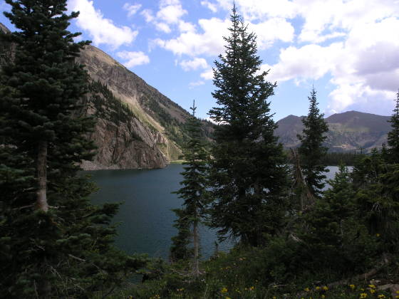
We rejoined our packs at about 10:45am and started up the trail to Buckskin Pass. The trail meandered down through a heavily forested area for quite awhile until the trees broke a little, and we were afforded a nice view of Maroon and North Maroon Peak at the end of the valley. Shortly after this view appeared, we encountered an interesting stream crossing, or rather, the trail just went straight into a large pond.
It appeared as though the stream had been dammed by beavers, and the swampy area that was there before had now become a full up pond, probably 2-3 feet deep in spots. We considered trying to wade across it, however we couldn't really see the trail in it, nor the other side, plus Brad would've had to go barefoot, so we went with Plan B.
We had seen a few trail offshoots about a hundred feet back, and we could hear the stream roaring to our left, so we headed over there. We found a reasonable place to cross the stream where the trail offshoot led us. Brad, however, had found an interesting log bridge – a weak and slightly burned log, spanning across a 6 foot
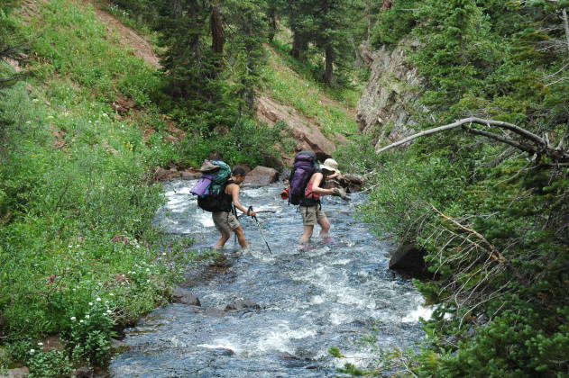
gap, with fast water rushing maybe 10 feet below. The rest of us took one look at the bridge, and started taking off our boots. Brad chose the log bridge (and made it safely, although he sort of crawled across it), while we crossed a few feet downstream.
The water was deep and fast, probably close to 3 feet at worst, but there was a nice clearing on the other side for us to regroup (and fight off mosquitoes). We continued up the trail, the pass starting to make itself known at this point. We climbed long switchbacks that meandered up the slope, occasionally traversing grassy slopes, then forested areas, until we hit tree line. Thankfully, Buckskin Pass had very generous switchbacks that traversed the grassy slopes above – still an arduous climb, but not as painful as the previous 3 (except that this was Pass #4, and we were all a little tired).

We hit the top of the pass around 2pm, and glanced down into the more familiar valley on the other side. We still had 3000 feet to drop, but we were all rather excited that we had no more passes.
After a snack at the top, we started our descent. The view of North Maroon Peak was spectacular, as were the wildflowers. At one point, the trail meandered through what appeared to be a recent avalanche path, with uprooted trees littered everywhere along the slopes, making the hillside appear to be some eerie wasteland.
As always, the pass descent takes longer than you expect. We finally hit the trail loop point near Crater Lake a little after 4pm, after what seemed like forever hiking down the steep trail. We had a little mini-celebration, knowing that we had actually completed the full loop here, but we knew we had about 1.7 miles left, except it was over trail that we'd been on before.
Unlike our hike in, there were far fewer people on the trail to Crater Lake this afternoon; most likely because the last shuttle bus leaves at 5pm, and, as expected, a thunderstorm was rolling in. We pressed on, and within about 20 minutes, it started to rain. I think we were all anxious to get to the car, so none of us bothered with any rain gear. At about 5:10pm, we hit the car; Maroon Lake was pleasantly deserted, however the rain discouraged us from dawdling for too long there…we were all looking forward to that hotel shower and greasy food!