Mt. Bierstadt (14,060 ft)
 skies")
After tackling Longs Peak two weekends before, my wife wanted a change of pace - something a little easier. While I'd climbed Mt. Bierstadt twice (it was my second 14er), she hadn't been up it yet. We'd invited a number of people to join us and ended up with our good friend Lonny Jacobson (whom I summited Bierstadt with 2 years ago in a failed attempt to tackle Bierstadt, the Sawtooth, and Mt. Evans) and some other friends: Rurik and Kathy Lubinski, plus their dog Wiley.
We left Denver from the T-Rex park and ride (Morrison Road and I-70) at about 6:15am and made it to the trailhead a little before 7:30am. Guanella Pass was, as it has been for the past two years, been under construction, and we were forced to wait at a few stoplights through some one lane sections. Guanella Pass, of course, starts paved coming up out of Georgetown, and then turns to dirt not too far up the canyon. In my opinion, the paved portion of the road is far worse than the gravel (the potholes in the pavement are huge) - but it's all very passable by a passenger car.
The trailhead, to my surprise, had moved a bit from last year (Lisa and I climbed Mt. Evans from this trailhead the year before ).

It appeared that they were still working on the main parking lot and the overflow lot, but the main parking area was now just a bit farther up the road and on the right. It was nice and sizeable and now has some pit toilets - a nicety given the popularity of this trailhead.
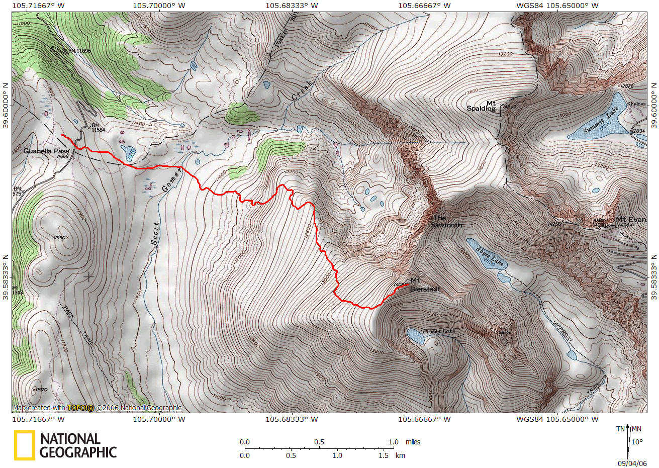
It was a cool morning at about 40 degrees, and we didn't expect it to warm up much, with the weather forecasts calling for snow above 11,000 feet (gotta love Colorado in August). We got underway at about 7:50am, heading down towards Scott Gomer Creek. The trail was nice and solid (albeit a bit muddy) through the willows, following the boardwalks through the boggier portions. Before these boardwalks were built (or for anyone who wants to tackle Mt. Evans), people would have to make their own path through the bog and the willows - a slow and tedious prospect!
We switchbacked up the trail above the willows in an hour, now on the grassy slopes below Bierstadt where it got a bit colder. By 9:30am we were to the most tedious section of the trail, where the angle gets a tad steeper on looser gravel. Since it was so cold, the ground was

mostly frozen, which actually helped to stabilize the loose trail, but the downside was that a stream that flowed down the trail was also frozen, making the hike a tad more challenging (although still quite pleasant).
By 10:15am, we were up unto the shoulder of Bierstadt, about 270 feet below the summit. Up to this point, the trail is nice and solid, but this region marks the transition between Class 1 and Class 2 hiking. We all started to scramble up the rocks to our northwest (Wiley occasionally had a difficult time, and Rurik had to help him up a few boulders, but overall he did fine), not finding much of a trail to follow. I seemed to recall that each time I've done this hike, I can never find the trail on the ascent, but descending it's easy to find (since all trail fragments go to the summit). We managed to summit around 10:40am (we would've been up a little sooner, but we were delayed by a CamelBak bladder hose malfunction - the kind of malfunction that spills water everywhere).

From the summit, normally you have a pretty decent view of some of the other nearby 14ers, but given the cloudy weather, we were only able to see Mt. Evans - just a stones throw away. We spent about 20 minutes on the summit - the temperature was now 34 degrees, with a pretty steady 15 MPH wind, so we were getting fairly cold. On our descent, we easily found a thin trail that led us back down to the rocky shoulder far easier than our ascent (incidentally - when looking at the rocky ridge line towards the summit, the trail is to your left - a little farther than you might expect it to be; of course, this trail isn't at all necessary - the scrambling here is solid Class 2 and not difficult).
As we descended back down the trail, we passed a lot of hikers still ascending (it was now about noon). In the morning, we had seen a handful of hikers, but figured that the cold weather had kept them away - alas, as with any Front Range 14er, there are always plenty of hikers! We took our time descending, going easy on our knees, and managed to return to the car at 2:10pm - thankful that Lonny had heated seats!

True to form, it took nearly 3 hours to summit, and 3 hours to descend - which was true for the other two times I've summited it too. Mt. Bierstadt is a pleasant mountain with no real surprises - the mountain is in view the entire time, and there are no false summits. There are a few places near the summit that might make a severe acrophobic a bit nervous, but overall the trail is well protected from even intimidating views!