Bald Mountain
Bald Mountain, 13,684 feet, forms much of the eastern boundary of the town of Breckenridge. It rises up just to the southeast of the town, forming a north-south ridge that is visible from I-70, and closely resembles Mt. Silverheels, which is a few miles south of it. Since we were spending the weekend in Breckenridge, it seemed like a good hike to do.
I encountered two routes for the hike, one was up from the top of Boreas Pass, along the southern ridge line, the other from the north ridge, as described on 14ers.com. The northern ridge seemed more interesting (and better defined) so we followed it.
Getting a later start then we wanted, we left the town of Breckenridge about 7:30am. Just south of town was the turnoff for Boreas Pass, so we followed it, however I missed the turn onto County Road 520 (which is marked as Baldy Road). We were watching the road signs increment from 508, 509, then 528, not able to figure out what we missed. On doubling back (after hitting the end of the asphalt), we noticed that 520 actually preceded 508 along the road. The other problem was the Trails Illustrated map I had (which was revised in 2002) indicated that this road was not paved...things have obviously changed since the underlying TOPO map was modified, as it was paved and ran through a subdivision.
We proceeded down Baldy Road towards the trailhead. The road bent to the right a touch, and a small dirt road proceeded along straight, so I headed down it. Continuing with my lack of navigational skills this morning, I hadn't realized that this was the "high clearance vehicle" road that was described on the website and on the map. My Honda Accord did okay, but I ended up scraping the undercarriage a bit on the way back down after the hike.
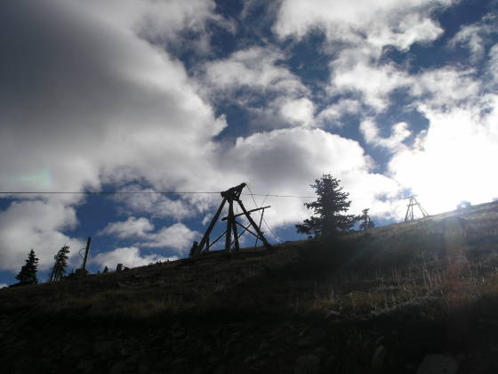
Upon realizing that I was now driving up the trail we had intended to hike, I pulled over and we started hiking, all around 8:00am. Of course, at this point (and the entire way we hiked) the trail was really a 4WD road, so the quality of the trail could not be better. After about a half a mile of hiking up a gentle 10% grade, we encountered the Iowa Mill, which appeared to be the processing facility for ore mined up the hill quite a way. The road began to switchback up the peak, crisscrossing what we presume to be some sort of ore-bucket transport system (a zip line down the hill?).

As we crisscrossed the mountain, the road went from fine dirt to large rocks and back again, but still rather pleasant. Around 12,000 feet, the road forked a bit. It was obvious that the left-ish fork made the switchback rather wide, and the right, though steeper, simply cut the corner a bit. Since we were on foot and the grade had been pretty pleasant, we opted for the right fork. The grade steeped to about 17%, but still very manageable.
At this point, a Jeep Cherokee that we had seen climbing up the road finally caught up to and passed us, proving that one can get much higher in 4WD. They took the left route around the switchback, and we essentially caught up with them at the top of the ridge where the two roads met again.

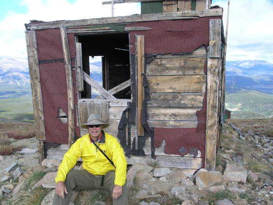
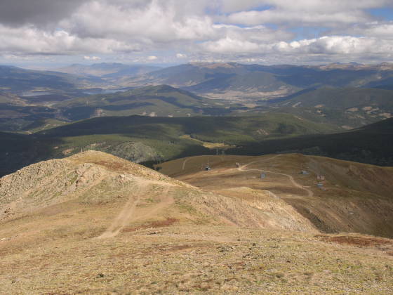
From here, Mt. Guyot, and much of the Front Range was visible, as we had crested the ridge at about 12,300'. It was about 9:30am now, and the clouds did not appear to be burning off as we had hoped. The wind up on the ridge was probably about 25 mph, so we took a brief stop in front of an old mining shack to don our wind gear. Surrounding us were about 4 antennas, and perhaps 2 or 3 that looked as though they had toppled in the recent past. This answered one of our questions Lisa and I had about this peak, which was what the subtle glints were that could be seen in the town.

Pressing on, the route continued to follow a road, however it became much steeper. It was difficult to find purchase on the dirt on some of the steeper sections, but not impossible. By the time we reached about 12,900 feet, the clouds were looking really dodgy. It was only 10:00am, but our recent experience on Mt. Shavano reminded us, once again, that storms do not necessarily keep time tables. Rather than chance the prospect of a ridge-run down to tree-line, we decided to turn back.
We hiked up a small pile of rocks to get a little photo, and noticed a grave marker for a couple that had died in 1909 and 1934! From this spot, the view was still terrific. You could see as far as Mt. Bross in the Mosquito Range, across the Ten Mile Range to Peak 1 and beyond. Mt. Evans, Grays and Torreys Peaks, and even Vasquez Peak were all visible.
This was a fun hike, and the vantage point was very unique, being able to see Breckenridge from a whole new angle. I look forward to attempting this peak again, hopefully the weather will cooperate more. (Of course, after we retreated from the ridge, the clouds seemed to lighten up again...stupid Colorado weather!)

Update: In August of 2007, Lisa and I went back to finish this mountain off. We decided that since we'd hiked the lower 4WD road already, we could cheat, so we drove up to the radio towers and started from there. It was shocking how long it took us to reach the summit: about 2 hours. The trail was mostly non-existent, and there were numerous dead ends where we encountered mini-cliff bands and had to backtrack along the ridge; plus, a steady 50 mph wind slowed us a bit too.