The Walkers' Haute Route - Chamonix to Zermatt
Intro
We first heard of the Haute Route after some of our friends returned from the hike back in 2004. Then, in 2007, another set of our friends tackled the journey as well (inspired by the first set). Both of them hiked the route without a group or guides using only the Kev Reynolds book; we took a cue from our friends and decided to do the route the same way - guideless and groupless. This required a bit more prep work but we found it to be well worth it!
Prior to the trip, I spent a good deal of time researching details from other trip reports, Google Earth, Kev Reynolds’s book, Alexander Stewart’s book, as well as the advice from our friends that had traveled the route. I found a few trip reports to be particularly helpful in both in preparing and on the trail. Lisa and I are experienced hikers in Colorado, but hiking halfway around the globe means that things are a bit different...and I like to be as prepared as possible.
As an added complication to our trip, my wife Lisa is gluten-intolerant (meaning that if she eats anything with wheat (gluten) she’ll feel incredibly ill and lethargic for about 3 days – not life threatening (for her), but a horrible inconvenience especially when hiking 8 hours a day...not as bad as full blown Celiac Disease (thankfully)). The added challenge of avoiding wheat along the route made things a bit more interesting, but thankfully she made it through the entire trip with no issues. All restaurants or hotels were accommodating of her dietary needs (the trickiest part was communicating!) and some places bent over backwards to make her a unique meal that didn’t contain gluten (that my wife still raves about). This trip report attempts to highlight some of the gluten challenges (or rather the lack thereof) we encountered along the way.
Costs
For your planning purposes, I’ve included costs of lodging, meals, and transportation in this report – this is to help you gauge what this trip cost us in September 2010. Your mileage may vary! Generally speaking, we tended to opt for mid-tier lodging and food: we happily opted for a hotel room (typically with a bathroom) instead of a dorm or hostile (I don't particularly mind communal sleeping, but I'm a horrible snorer…and I just don’t want to put anyone else through that suffering). In a similar vein, our meals were usually at nicer sit-down restaurants and included a small (500ml) bottle of wine and dessert. You could certainly spend less than we did on lodging and food, but you could also spend quite a bit more. Just keep that in mind when you look at our meal and lodging costs and plan for your own trip.
Our Trip Philosophy
Many, it seems, approached this route as a chance to hike all the way from Chamonix to Zermatt. Our approach to this trip was a tad different (but similar to that of our friends that had done it before): we aimed to hike from Chamonix to Zermatt, but where there was a road that took us where we wanted to go (i.e. typically down a valley), take a bus - hiking along a road just doesn't seem all that fantastic. While we thought the Swiss countryside was absolutely beautiful, we were really doing this trip for the views, not the valley walks. As such, we decided to selectively skip a few stages or shorten others where mass transit was available. This approach allowed us to shorten the journey to nine days of hiking and include rest days when needed (or weather demanded).
I hope that this trip report helps you in planning your route!
Resources
Trekking Chamonix to Zermatt: The Classic Walker's Haute Route - Kev Reynolds
This book is absolutely critical. Buy it and take it with you – it has nearly everything you’ll need to know about the route plus some details about each town (including lodging and restaurants).
We used the 3rd Edition of this book (published in 2002) that our friends had given us after their trip. I strongly recommend picking up the latest edition! The newer versions seemed to have a lot more details that our book lacked (we skimmed a few pages from other folks we met in the cabanes).
The Walker’s Haute Route – Alexander Stewart
This book was a nice compliment to Reynolds; we found ourselves referring to both along the trail and in prepping the day before. Half of the book contains interesting facts about Switzerland, including flora and fauna which makes for interesting reading on the flight over, or each night along the trail. This book also contained good, detailed maps of many towns with more information than Reynolds had. I would recommend picking this book up too and taking it with you as well - it was worth the weight. If, however, you wish to only take one, I would say that Reynolds is more critical to have.
Trip Reports
While we were planning the trip (and even on the trail) we read these trip reports and found them to be exceedingly useful:
Our Friends
Our two sets of friends both had notes as to where they ate and where they stayed – this information was invaluable, and hopefully this trip report can relay that information. If not, please don't hesitate to drop me an email at .
What to pack
I agonize over what to bring on a weekend backpacking trip...so I really was struggling with my pack list for this trip. I'd never hiked for so many days back to back and wasn't sure exactly what weather to expect either. As an added complication, we weren't doubling back on our route, so we couldn't store any luggage anywhere for our after-hike trip down to the beaches of Italy - everything we had for our trip we had to carry.
I made my pack list in Excel (yeah...I'm a nerd like that...isn't it obvious already?) , so I’ve decided to share it here instead of listing out what to bring and what not to bring (keep in mind, I’m an uber-geek, so there’s lots of nerd paraphernalia that I traveled with that many of you won’t need to). My pack weighed around 40 lbs. with water and food, Lisa’s was little less. As I mentioned above, we also had to pack for an additional week after the hike which drove some of our decisions (such as the day bag and bathing suit) in what to bring.
Food and Water
We brought enough Clif Bars/Kind Bars from home to have about 2 per day of hiking; this is our preferred trail food and we suspected (correctly) that they would be difficult to find along the trail. While I could have made do with any brand of energy bar, Lisa's gluten intolerance meant that finding an energy bar might be more difficult. In addition to this food, we stocked up on lunch items along the way:
- I would purchase a baguette (available in every town) and pull chunks off of it for 2-3 days (I reused a baguette bag that I got in Chamonix, which helped keep the crumbs from getting everywhere in my bag). Obviously, Lisa didn’t eat any of this.
- Every other day, we’d pick up about 200g of local cheese, plus a sausage, 2-4 apples, and some chocolate.
- The local food, supplemented with Clif Bars (or gluten-free Kind Bars for Lisa) worked really well along the trail. We typically ate the fresh food as our lunch.
One word of caution: Plan ahead for Sundays (or cabanes) when you may not be able to restock. We spent three hours wandering around Les Haudères looking for a place to buy food on Sunday (until discovering a grocery store on the edge of town). You can purchase a bag lunch from the cabanes, but we never did.
For water, we brought our 3 Liter CamelBak bladders and filled them up each morning. With the exception of the cabanes, tap water was readily available (and some towns even had a drinking water spigot available). At the huts we either purchased (expensive) bottled water or filled up with their hikers tea.
GPS Route
If you're looking for waypoints and routes to download to your GPS, here was our route:
GPS Basemap Resources
Prior to the trip, I upgraded my old Garmin eTrex Vista that was getting a bit long in the tooth to a new Garmin Oregon 300. In scouring the web for GPS routes of the Haute Route, I found a lot of free Garmin-compatible maps to load into my GPS unit. The best I'd found was from kowoma.de (site is in German, thankfully Google Translate does a decent enough job to make it navigable in English. This site provides a very nice map of Switzerland based on OpenStreetMaps that can be loaded into nearly any Garmin unit (and the Basecamp software). The map is fully routable and includes topo lines and most major features - it displays very nicely in Basecamp and on the Oregon unit. If you cannot navigate the kowoma.de site or you've got a Mac, I've mirrored a version of their Switzerland map that you can download here and load into Garmin Basecamp (then transfer into your GPS via MapInstall) below.
During route planning, I found mapplus.ch a very useful resource as it provides high detailed Swiss topo maps, including the ability to export map tiles into Google Earth.
- kowoma.de Swiss Garmin Maps
 switzerland_mapsource_09.04.2015.exe - mirrored Swiss map from kowoma.de (install for Basecamp on Windows)
 kowoma_switzerland_20130617.gmapi.zip - mirrored Swiss map from kowoma.de for Mac OS X Basecamp (use Garmin MapManager to install)
- mapplus.ch - Official Swiss topo maps online
I've also put together more general GPS receiver map resources here.
Day 1: Arrival in Chamonix (August 30, 2010)
We flew from Denver through Washington Dulles to Geneva, Switzerland. We made reservations on Alpy Bus to get a ride to Chamonix which took a little over an hour. (An important point: the ATMs in the Geneva airport only dispense Swiss Francs; but Alpy Bus would only accept Euros since they were taking us into France…I had to withdraw Francs and exchange them to Euros at the exchange counter).

We arrived at our hotel in Chamonix around 10:15am (Hotel de L’Arve (€95)). The hotel was small and unassuming, perched right alongside the chalky white L’Arve River. Our room wasn’t ready when we arrived, but they allowed us to drop our stuff in the unmade-up room and change clothes, then provided us with our Chamonix valley bus passes, allowing us travel throughout the valley (we used these to get to Le Tour the next day for free). The hotel had decent sized rooms (recently remodeled) with free Wi-Fi (or a pay-for-use computer in the lobby).
After dropping off our gear, we wandered around Chamonix, exploring the town in the cool light rain. We ate lunch at Bar Creperie La Ferme for €19. This was Lisa’s first chance to dust off her college French and try to explain that she couldn’t eat wheat (Lisa had printed out a set of cards in French (and German) that explained Celiac Disease and we always had those at the ready in case the language barrier got in the way)…the conversation was a bit rough but they found the waitress who spoke English.
Following lunch, we rode the cable car up to Le Brevent across from Mont Blanc. At €48 for both of us, it was significantly cheaper than the cable car up to Mont Blanc itself, plus we figured the view would be more grandiose. From the summit, we could make out Col de Balme in the distance: tomorrow’s first pass.
Dinner was at Le Monchu with a tasty prix fix menu for €43 for the two of us.
Day 2: Le Tour to Col de la Forclaz (September 31, 2010)

We opted to skip the hotel’s breakfast (€10 per person) because they just didn’t seem to have a lot of gluten-free breakfast options; instead we walked down to the nearby Super U grocery store to pick up

some breakfast before heading out to the bus stop.
We decided to skip the Chamonix to Argentière stage since it basically followed a road the entire way. Our original plan was to take a bus to Argentière, but then quickly realized that the walk between Argentière and Le Tour was also just another road walk, and the bus could take us all the way to Le Tour…so that’s where we began our journey.
Once we reached Le Tour, we were extremely tempted to hop on the gondola and reduce our hike by a thousand feet or so, but we decided against it. Better to get at least a few miles under our belts early! We hit the restrooms at the base of Le Tour and began our hike up at about 9:40am. It was a bitterly cold but clear day – the wind was whipping down from the pass in sustained gusts of 20 mph, making the 45°F weather even colder. We hiked along a dirt road that traversed underneath the gondola, occasionally departing the road for a foot path that cut a long switchback here and there.
We reached the top of the gondola about an hour after we started, and the summit of Col de Balme (7,244 ft) and the Swiss border an hour after that (11:40am). The border was surprisingly anti-climactic – it was just a cement post in the ground. Next to the cement post was what was to become an all-too-familiar sight: the Swiss trail signpost.
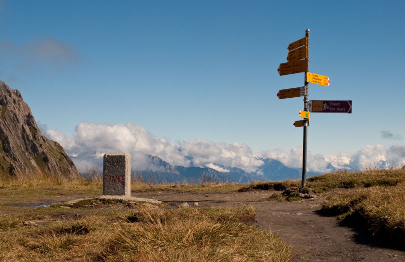
These signs were ubiquitous all along the trail with yellow arrows (tipped in red and white) pointing in a number of different directions indicating towns or landmarks and their distance in terms of hiking time. (Oddly enough, a CAIC (Colorado Avalanche Information Center) sticker was stuck to this pole…it’s good to see a little slice of home so far away!)
Perched atop Col de Balme is the Chalet-Refuge Col De Balme, a small gray building with bright red shutters and a small outdoor deck. Lisa and I needed to warm up from the wind and the cold, so we went in. We ordered some french fries and hot chocolate while we chatted with some locals from Argentière (who told us that it was unseasonably cold…that gave us a bit of hope) and some other hikers traveling the Tour du Mont Blanc in the opposite direction as we were traveling.
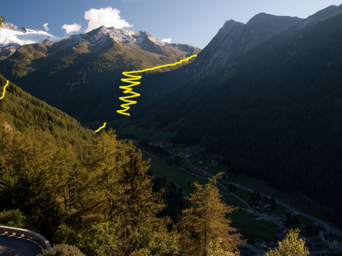
After warming ourselves for about an hour, we began the descent down into Trient around 12:40pm. The trail descended gently at first, giving us a view of both Trient in the valley below and Col de la Forclaz across on the far side of the valley. About 1.4 miles from the col, the trail steepened significantly (from an 18% grade to a 32% grade) for about a mile, dropping through the forest in tight switchbacks. Eventually, the trail leveled back out on the valley floor and crossed a small stream. To our right, we could see up to the Glacier du Trient and Fenêtre d’Arpette (tomorrow’s challenge) as we arrived into the southern side of Trient. There was a public restroom located just off the trial here.
Based on our lodging options in Trient and the fact that we’d had a light day of hiking, we decided to continue hiking up to Col de la Forclaz another 1.2 miles
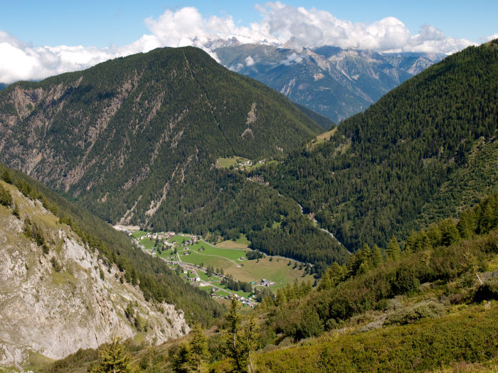
to gain 1000 feet on tomorrow’s hike (in hindsight, this was an extremely wise move, as the climb to Fenêtre d’Arpette had enough elevation on its own). (As a side note, we found out later from two different sets of hikers we met along the trail that the dortoir in Trient was a very entertaining place to stay: the proprietors would serve numerous types of cheese and explain the origins of each type; additionally, you were not allowed to eat until all the children returned home for the day. Many described this lodging as one of the most amusing on the trip!)
From the south side of Trient (4,443 ft, 2:40pm), we continued following the signs up towards Col de la Forclaz. The trail climbed steeply up the hillside, eventually crossing the road that led to Col de la Forclaz. (Watch this trail crossing - we missed it as the trail does not directly cross the road, you have to hike down to your right about 100 feet to pick it up in the correct location). Eventually, the steep climbing trail intersected another flat trail along a bisse (irrigation channel) and we followed this to Col de la Forclaz for about half a mile (this is the same trail we’d double-back on the next day). We arrived at Col de la Forclaz (4,985 ft) at about 3:20pm, about 5 and a half hours after departing (including breaks).
Before departing Chamonix, we’d asked the hotel front desk to call Hotel du Col de la Forclaz to make us a reservation. We ended up with the nicest room at the hotel (Room #2) with lots of sunlight from a west-facing window and a small porch overlooking the Trient below! Upon arriving, the hotel had us remove our boots and place them in a mud-room. They did have slippers available, but most of them looked pretty disgusting (just in terms of dirt).
We were happy that we brought a pair of sandals but learned an important lesson: keep them packed near the top of your pack!
Once settled in our room, we started what became our nightly routine: washing our clothes in the (extremely tiny) sink. We found that laundering our clothes each night kept the dirty clothes pile minimal (which is good, since we really only had two sets of everything) and if we had a balcony, we could line dry our clothes in whatever sun we had left. (Here's a great travel tip: take your wet clothes and roll them up in a towel, then wring them in the towel; this will keep the clothes from stretching when it's wrung and the towel will absorb a significant amount of moisture. Also, pick up an elastic clothes line at somewhere like REI - they hardly weigh anything and they're invaluable for drying clothes)
The hotel was 184 CHF for a private bathroom and half board (rooms without bathrooms and even tent sites were also available). The staff spoke a little English and Lisa’s French came in handy. The hotel was relatively busy for dinner – presumably with many hikers on the TMB (Tour du Mont Blanc) and a few that had just stopped in for a nice dinner. The half-board dinner was a four course meal (which we supplemented with a small bottle of wine) and they were very accommodating of Lisa’s gluten intolerance.
Day 3: Col de la Forclaz to Champex via Fenêtre d’Arpette (September 1, 2010)

Breakfast at Hotel du Col de la Forclaz was bread and croissants with jam and butter. Lisa asked for something without gluten and all they had to offer was an apple and an orange. We hit the trail around 9am, opting for the route over Fenêtre d’Arpette rather than the Bovine Route.

It seemed that most of the other guests had departed an hour earlier but, alas, we were still recovering from jet lag and got a bit of a later start.
The trail started off with a pleasant walk along a bisse. The trail barely climbed at all, gaining just 800 feet of elevation over 2 miles. The side of the trail dropped steeply down the mountain into Trient below offering a great view of the town (but the exposure made me a tad uncomfortable at times). After an hour of hiking, we reached Chalet du Glacier (about 2 miles from Col de la Forclaz). The Chalet hadn't opened yet for the day (the proprietor arrived just as we were departing) but we took the opportunity to shed some layers since the trail was now turning into the sun - this was a nice change, as we were concerned the entire hike was going to be as cold as our first day had been. Another group arrived at the Chalet as we started to head off: a guide-led group of 12 from the UK that was also doing the Haute Route. We ended up leap-frogging this group continuously throughout the day and, as it turned out, the remainder of our trip!
From the Chalet, the climb became grueling. The trail from Col de la Forclaz to the summit of the pass was 4.2 miles with 4350 feet of elevation gain; we'd just hiked 2 miles and only gained 800 feet, which meant we still had 3500 feet left to climb…and only 2.2 miles to do it in – that translates into an average grade of 31%. Between the elevation gain and the fact that this was our second day of hiking, this stage was probably one of hardest on the entire trip. The plus side, however, was that the hike climbed up a beautiful hillside and we had an unobstructed view of the Glacier du Trient the entire climb - yielding one of the most spectacular views on the entire hike as well.
We slowly ascended towards the pass, the trail first winding through the forest then emerging onto a meadow. Prior to emerging from the forest we encountered the first fixed chain along the trail on a rocky promontory.
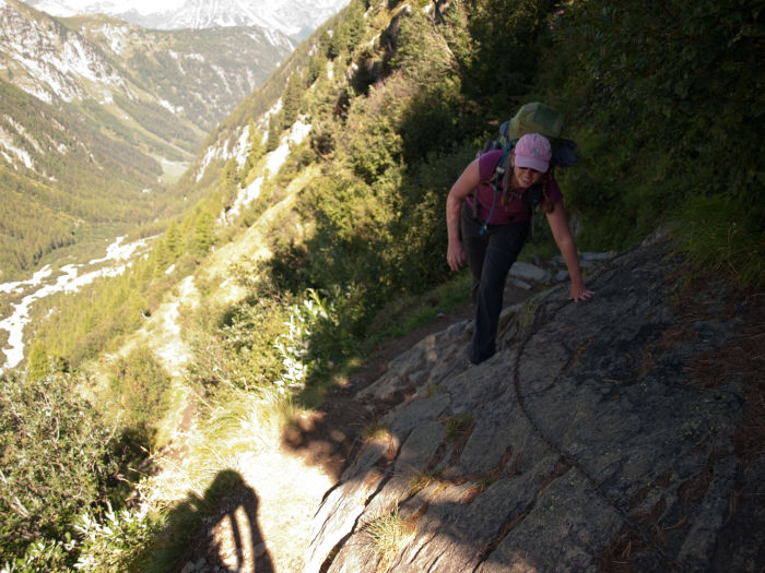
The trail around the rock was about the width of two boots with a decent drop, so the chain offered a little more security as you rounded the slanted rock (of course, Lisa chose to ignore the chain…I held on for dear life; you’ll start to notice a trend here).
As we climbed the view to our left were of amazingly carved valleys pouring down from the top of the ridge, and to our right the Trient glacier. I stumbled a number of times along the trail just from sheer distraction! The tour group occasionally caught up with us on the trail, passing us. Generally, they were faster hikers than we were (we’d like to think it was because there packs only weighed 10 lbs. since there luggage was carted from town to town by the tour group) but they took frequent breaks for the group to catch up and to snack so we continually passed them.
As the trail approached the summit of the pass it got a bit rockier requiring occasional scrambling. I found it useful to stow my hiking poles for the final stretch. 3 hours after leaving the Chalet, we arrived at the summit of Fenêtre d’Arpette (8,769 ft, 1:20pm). This pass was the busiest pass of the entire hike. The summit was packed with people (all of whom spoke English) and it was a little difficult finding a spot to sit and have lunch. In chatting with the others on the summit, everyone else was coming from the Champex side of the pass following the TMB route. Oddly enough, the view at the summit was not as spectacular as it was on the hike up. True, looking down into Val d’Arpette was nice (hence the name of the pass, meaning Window of the Arpette), but the Trient glacier was now out of view.

We rested for about an hour on the summit of the pass in the warm sun. After getting our fill of cheese, chocolate, sausage, and bread (for me) we began our steep descent down the other side. Unlike the ascent, there was no scrambling here; instead, the route was steep braid of slick dirt trails the dropped 300 feet in 400 feet of walking (a grade of 61%). Extremely slow stepping was the name of the game here, as the dirt was loose, and small rocks could easily be dislodged (which would roll down onto the trail segments below). I found my hiking poles to be invaluable on this section, but Lisa did fine without any.
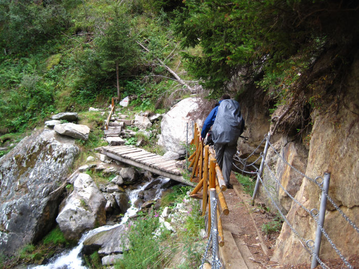
It took us about 20 minutes to get down this steep section of trail which eventually gave way to a large boulder field. The boulder field required some scrambling to get up, down, and around the large boulders. We leapfrogged with a French-speaking tour group as we slowly picked our way through the rocks, following the red paint arrows (and occasional blue paint blazes as well). After about 30 minutes, we were finally back on a solid trail and our pace picked up. The trail contoured along the valley wall, continuously losing altitude until it reached the valley floor (about an hour and a half after leaving the summit of the pass). We took a break to eat some more food before continuing down the valley floor.
The trail continued to drop at about the same grade, but the plants changed from alpine tundra, to taller grasses, and finally to a forest.
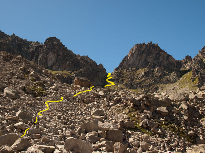
About 1.3 miles after reaching the valley floor, we emerged from the forest into a pasture above the small town of Arpette, another 0.7 miles ahead. As we approached Arpette, the trail joined a road that led down to the hotel in town. Past the hotel, the trail descended next to a nice little waterfall and forked. Lisa and I took a wrong turn (we went right) at the base of the waterfall. Had we gone left, we would’ve stayed on the trail that led to Champex, but instead we ended up on a paved road down from Arpette to Champex. This was really fine with us: the road was steep but paved and the level surface felt rather nice on our feet contrasted against all the rock we were on during the day. The road switchbacked through a small ski area just above Champex and eventually dumped us onto the west side of town. (I believe the trail to the left would have popped out in the exactly the same spot.)
We strolled into town around 5:30pm after hiking for 8.5 hours. First on our agenda was to hit the tourist information office, as we hadn't arranged any lodging yet. The tourist office showed us a hotel price list and provided us with a bus schedule for tomorrow's trip down to Verbier. We settled on Hotel du Glacier, which came highly recommended from some of our friends that had hiked the route before.
Our room at Hotel du Glacier was spacious with a super comfortable bed, a nice sunny porch (perfect for drying laundry), a small sink, and a shower all for 160 CHF, including breakfast. The hotel also had a sauna and whirlpool. The front desk spoke perfect English as well.
Once we showered and did some laundry, we headed out to grab dinner and restock our trail supplies. The grocery store had
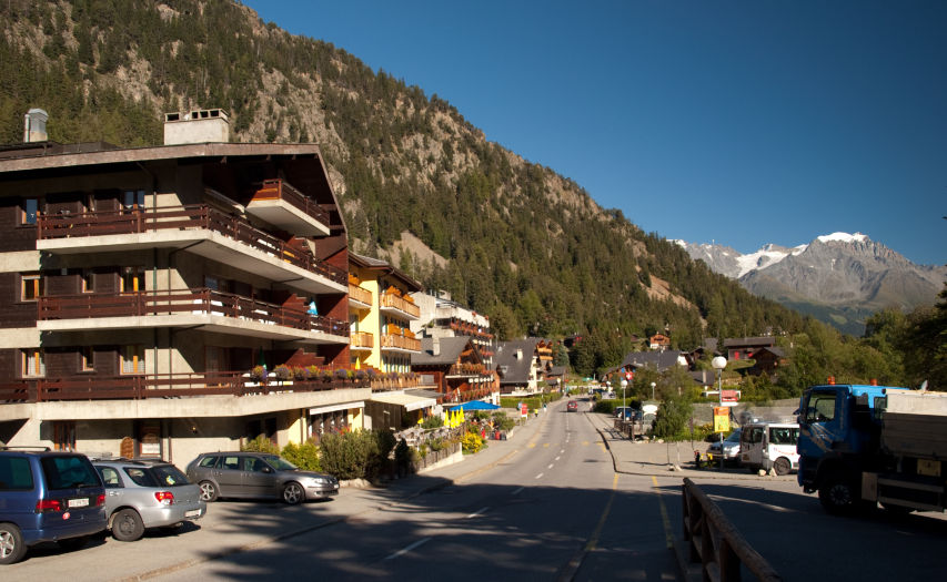
closed at 6:30pm, so we knew we’d have to hit in the morning before we left town. I got some money at the ATM (located next to the bus stop and grocery store) and we ate dinner at the Rand-evous Bed & Breakfast on the east end of town. We perused several menus before deciding that this was the place to dine for the evening. Lisa had selected it because they had a steak special that looked good. Thankfully, before ordering, Lisa recalled an important piece of French vocabulary that she had forgotten: cheval, in French, means horse. The steak de cheval special she saw on the sign out front was a horse steak. (We ended up having a lengthy discussion about this with a Belgian we met later on the trail – eating horse seems completely normal in most of Europe…but to us Americans, it just seems wrong). We avoided eating Mr. Ed and instead ordered cheese and tomato fondue, plus a wonderful dessert.
Day 4: Champex to Verbier (via bus/train); Verbier to Cabane du Mont Fort (September 2, 2010)

Breakfast at Hotel du Glacier was a fantastic buffet; they had croissants, bread, jams, meats and cheeses, yogurt, and boiled eggs. Lisa had plenty of gluten free options available to her. Once we finished breakfast, we asked the front desk to call Cabane du Mont Fort and Cabane de Prafleuri to make reservations for us that night and the subsequent night. Afterwards, we hit the grocery store near the bus stop to re-stock (in hindsight, this would’ve been just as easy in Verbier). The small grocery store had sausage, cheese, and fruit but they had no bread. I had to run up to the bakery half a mile up the road to pick up another baguette for my pack.
The stage from Champex to Le Châble was hiked by one of our friends, but the others had skipped it. We decided that the valley walk, while pretty, was worth skipping. We opted instead to take a bus to Orsières, a train from Orsières to Sembrancher, another train from Sembrancher to Le Châble, then finally a bus from Le Châble to Verbier.
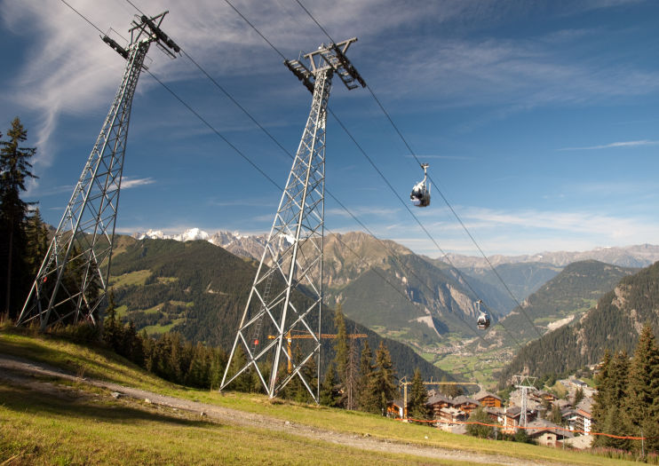
We took the 8:25am bus out of Champex-Lac down to Orsières; we were able to purchase our tickets on the bus (all the Postbusses had the ability to purchase tickets onboard, even without exact change). As an entertaining twist, our bus turned out to be the school bus, which stopped to pick up numerous grade school age kids as we switchbacked down the mountain. Once in Orsières, we caught the train into Sembrancher then changed trains to get to Le Châble. From here we chose to catch a bus up to Verbier. (Note: we didn’t realize this at the time, but the Postbus and Train systems are linked – you can purchase tickets to Verbier as you get on the bus in Champex-Lac; instead we ended up buying tickets for each leg of the journey). The cost of the bus/train was 37.60 CHF for both of us.
We arrived in Verbier around 10:40am. We decided that we should do at least some hiking during the day, so we opted not to take the gondola up to Les Ruinettes and instead found our way out of Verbier and onto the trail towards Clambin by following the signposts within the town.
After carefully following signs out of Verbier, we found ourselves following a forested trail that cut across a number of different ski slopes and dirt roads. As we climbed, the ridgeline we crested yesterday came into view, offering a spectacular glimpse of where we had come from. Additionally, the Combin massif dominated our sight lines as well. We arrived at Clambin after 45 minutes of hiking (about a mile outside of Verbier). The restaurant was closed, but we decided to stop and eat our own lunch on the sunny deck anyway. It was here that we met the Belgians – three men and one woman that were also tackling the Haute Route; we talked for a while as we ate (their English was impeccable); this was another group that we encountered many times along our route.
After lunch, we hiked up towards Les Ruinettes (where the gondola would have dropped us off). The trail we were on was dedicated to foot traffic, whereas a parallel trail system was dedicated to downhill mountain biking; the trails criss-crossed in a few places which meant you had to pay a little attention to a mountain bike flying down the hill at you (but only in those trail crossing locations, thankfully). Once we emerged from the forest we were offered an amazing view of the Combin massif and the entire valley of Verbier below.
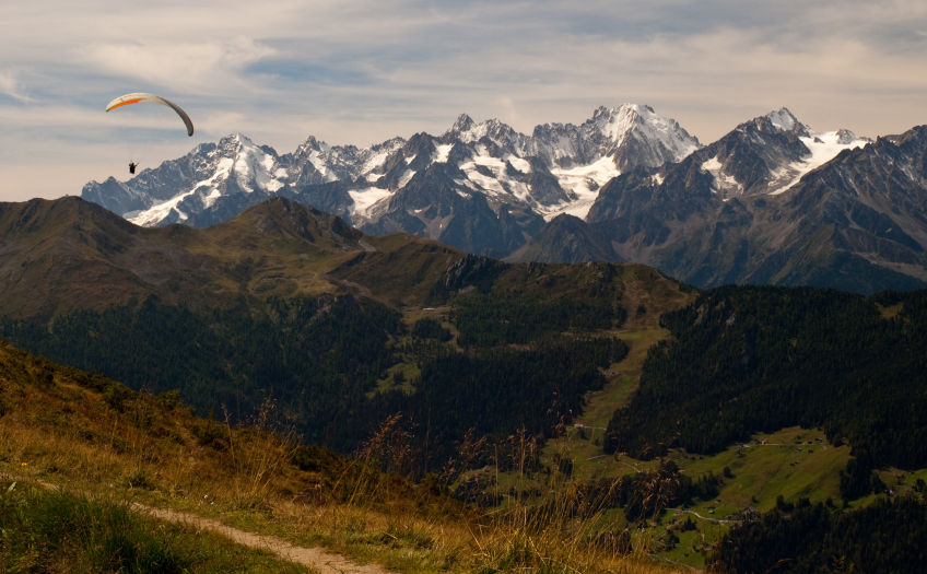
While taking a break to soak in the view, we met a group of three British men also on the Haute Route which we got to know a bit more the next two nights at the huts. Continuing on, we arrived at Les Ruinettes about 1.5 hours after leaving Clambin (including our rest stop time). The trail continued on, following another bisse gently up and around the flank of the mountain. From Les Ruinettes, the trail climbed another 1000 feet gently over 2.3 miles until it reached Cabane du Mont Fort. (This portion of the trail was made particularly exciting for us by the dynamite blasting that was occurring in the same valley, presumably for road construction purposes...nothing quite like the sound of high explosives while on the trail!)
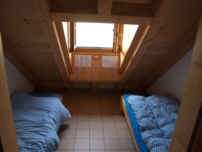
We arrived at the Cabane around 2:30pm (8,057 ft). We checked in with the host (who spoke very little English) who showed us to our private room on the top floor – a small room with two twin beds (with pillows and down comforters), electric lights and a power outlet (140 CHF half-board). We explored the cabane a little and were incredibly surprised to see a poster of Arapahoe Basin, a popular Colorado ski area, hanging in one of the rooms! The cabane had 3 minute showers available for 5 francs, but we decided to skip the shower. I ordered a beer and returned to the spacious deck out in front of the cabane to soak in the remaining sun of the day while Lisa tried to explain her gluten intolerance to the cabane host. After joking with her (indicating that our meal of the night was veal sweetbreads), he said that there wouldn’t be a problem with her gluten intolerance (he did recommend that this should be mentioned ahead of time when making a reservation). She joined me out on the deck, where we got a chance to get to know the Brits (the three British men we met earlier on the trail) and the Belgians better (as they were also staying at the Cabane for the night) until the sun went
behind the clouds and it was too cool to remain outside.
By the time everyone arrived, the hut had about 30 people staying for the night: the Belgians, the Brits, the tour group we met the day before, a Welsh couple we ended up sharing a room with in the next Cabane, a solo hiker from New Zealand, and a few others. All except three were hiking the Haute Route in the same direction as we were (the others were hiking it, but going the opposite direction), and everyone staying there spoke English.
Before dinner, everyone gathered out on the deck to watch the sunset over the ridge to the west. The view was absolutely beautiful, and a good chance to get to know our hut-mates a bit more.
Dinner was a spectacular three course meal with salad, bottomless spaghetti, and a pudding dessert. The host was very accommodating of dietary issues; he made a meatless sauce for the guide of the tour group, who was a vegetarian; and for Lisa he prepared a wonderful plate of roasted vegetables (Lisa still raves about that meal to this day as being the best of the trip). After dinner, some folks stayed down in the dining room and played cards or read.
(Note: the Cabane had electric lights, cell service, and running water that you could fill your water bottles with, however they didn’t have any hand soap. This is one item I’d recommend bringing along on the hike).

Day 5: Cabane du Mont Fort to Cabane de Prafleuri via Col Termin, Col de Louvie, and Col de Prafleuri (September 3, 2010)

Breakfast at Cabane du Mont Fort was fairly typical – breads, jams, meats, cheeses and fruit. We hit the trail a little after 8am with the Brits after the tour group departed, figuring we’d let them get some distance ahead of us. The three "reverse" Haute Route hikers were talking the night before about how miserable Col de Chaux was as a pass - they said it was super steep screen and terrifying...based on this assessment, we chose Col Termin. I was anxious about Col Termin and its exposure exposure along it (which Stewart calls a “Spectacular Balcony Path”), but also wanted to see the

views that both guide books raved about. Plus, the alternative didn't sound that appealing.
It was a cool morning and the trail was still shadowed by Bec des Rossos (which we were contouring around). The trail was slick in spots from some morning frost, but generally the trail was pretty solid. Even before reaching Col Termin, the trail started to exhibit some exposure (at least in my opinion…in comparing notes at the days’ end, many other hikers didn’t even notice it). The slope we were traversing was quite steep at times (often 45 degrees or more) narrowing occasionally to just two bootwidths wide....since I'm a bit of a klutz, these sections made me a bit wary. In places where the trail contoured around a promontory or a rock feature, the trail had fixed chains anchored into the rock to provide some stability. One of the observations many of us had at the hut that night was that these chains were frequently unnecessary where placed and would've been far more helpful had they been a few hundred feet farther down the trail! The exposure started making me real anxious...but the views of Grand Combin and the valley below couldn't be ignored and played a wonderful distraction!
We reached Col Termin (8,685 ft), 3 miles from the Cabane, at 10:20am, about 2 hours after starting our hike.
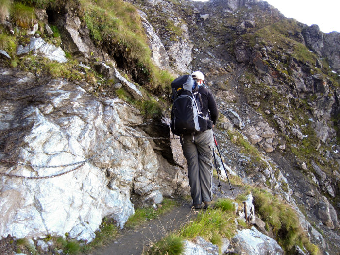
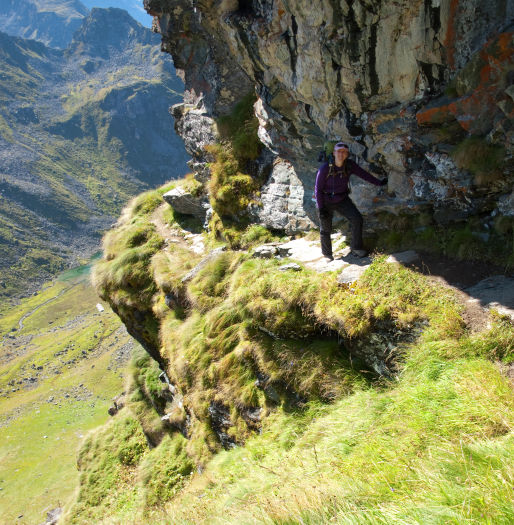
The Col offered a fantastic view of the next valley and a good place to stop and eat some food. After a 15 minute rest, we pressed on towards Col de Louvie. The next 1.5 miles were nerve wracking for me (as you can tell, I’m not big on heights or exposure…). The trail contoured along the eastern side of Bec Termin and Bec de Rossos gaining only a few hundred feet of elevation. Towering high above us on the left of us was the ridgeline; to our right, the valley, dropping precipitously below us. Most of the time, the trail just cut across a steep angled grassy slope (possibly a 50 degree angle?) but at times the slope gave way to a sheer drop below. Where the slope dropped quickly, fixed chains were in place to provide additional stability. It took us about 1.5 hours to cross the exposed section of trail, mostly because my pace was exceedingly slow in the exposed sections of trail. Lisa, thankfully, wasn't phased at all by the exposure and didn’t seem to mind the trail at all. This was Lisa's favorite day of hiking because the views were non-stop amazing.
Eventually, the trail and the valley floor converged, meaning an end to exposure. All that was left was a steep of 700 more feet up to the summit of Col de Louvie.
The trail was steep and rocky, but stable...and not exposed so our pace picked up a bit. As we reached the summit of the pass, we saw a herd of ibexes (ibi? Not sure what the plural form of an ibex is...) on the rocky ridgeline to our right. We summited the pass (9,916 ft - the highest pass of the route for us) at 1:10pm, about three hours after reaching Col Termin – here, we caught up to the Tour Group as they were just beginning their descent of the Col.
We took a 15 minute break to eat some lunch (one of my mistakes on this entire day of hiking was not eating enough along the trail – I was so anxious about the exposure that I didn’t think to eat which, in one of life's cruel ironies, just made me more anxious). The descent into the Grand Dèsert was a bit slow – there were still a few small snow fields at the top of the pass that we had to descend – nothing too large, but sloped enough that it would be easy to slip on (with large pointy rocks at the base) so we took our time.
Once past the snow fields, the descent was basic rock picking like , following the blazes as we descended. Below us was a vast wasteland of rock and ice (very similar to the terrain on a lot of Colorado 14ers). It took us about 40 minutes to descend the half mile to the stream crossing at the valley floor, constantly watching for red and white paint blazes on the small rocks as we went (cairns were scattered everywhere which were a bit hard to spot against the backdrop of even more rock, and there were so many that they were relatively unreliable as navigation aids).
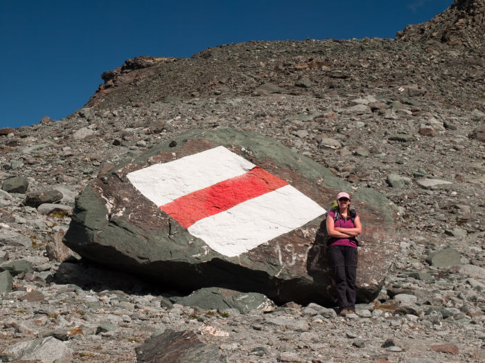
The stream had a set of rocks forming steps to cross (I probed the depth of the stream while crossing and I couldn't hit the bottom with my hiking pole). We continued to follow the painted rocks (and the groups we saw ahead of us) until the trail regained a shelf high above the valley (about an hour after the stream crossing). The rock character changed quite dramatically along this shelf – rather than picking our way through scree and talus we found ourselves rock-hopping across giant boulders and small ponds (which was actually a lot of fun).
Unfortunately, we weren’t done climbing yet (like we had thought). The trail dropped 150 feet down a rocky wall, forcing us to do some Class 3 scrambling to get down into another small valley before we could begin our final climb to Col de Prafleuri. The trail then skirted around two small tarns, dropping yet another 150 feet from the shelf we had been on before it began to climb steeply towards the Col, 400 feet above.
We reach the summit of Col de Prafleuri (9,643 ft) around 4:00pm, 8 hours after we started. 1000 feet below, we could see a few different groups hiking across the heavily quarried valley towards the cabane, still over a mile away. From the pass, we could also see over the top of Col de Roux and to Col de Riedmatten/Pas de Chèvres of the next day. After another snack break, we began our descent into the valley below. The trail dropped steeply down 500 feet with a grade of 31% but the
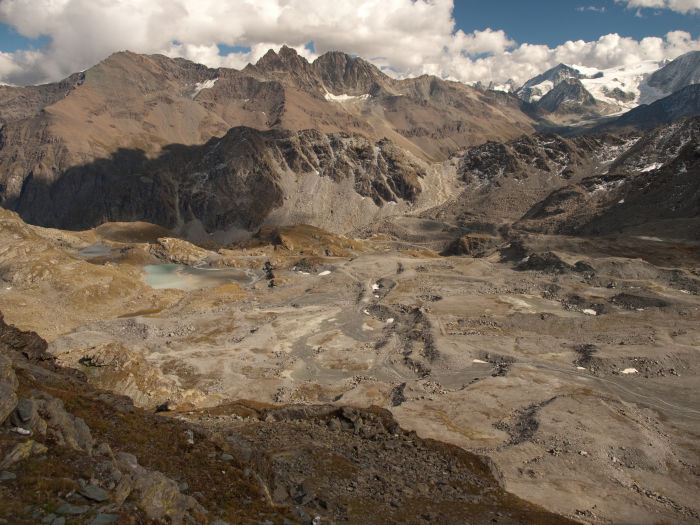
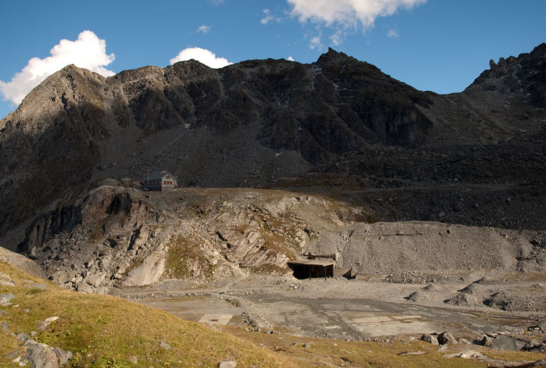
dirt held pretty steady under our feet (this was another spot that I was thankful to have hiking poles). Once on the valley floor, we walked about half a mile towards the cabane before realizing that we still had another 400 feet to descend before reaching the cabane. The trail dropped steeply again down a gully directly above the cabane. The bottom of the gully was 120 feet below the cabane...so we had to reclimb that lost elevation. Thankfully, the Swiss had the forethought to place a trail sign indicating that Cabane de Prafleuri was a mere 5 minutes away (geee...thanks).
We finally reached Cabane de Prafleuri at 5:30pm, 9.5 hours after setting off that morning (our longest hiking day of the trip). Once we arrived at the cabane (122 CHF), we checked in with the host (who spoke English) and were shown to our room. Our room had a double-sized bunk bed (with pillows and down comforters) that we shared with the Welsh couple we had met the night before (the room next to us had a triple layer bunk double-sized bunk bed!). Electricity could be purchased for 5 CHF to power an overhead light, a heater, and one power outlet (I believe the power lasted about 8 hours). The bathroom was co-ed; an odd experience for many of us there – the toilet and shower stalls (3 minute showers were available for 8 CHF) were fairly private, but there were urinals out in the main area of the bathroom. The sink indicated that the water was non-potable (we drank a little, but opted to buy water for our packs the next day: 1.5 L for 8 CHF. Note: potable water is available on the trail about a mile into the next days’ hike). There was a hint of cell phone service if you stood on a rock located behind the cabane.
Lisa mentioned to the host that she was gluten intolerant and the host indicated that this would not be a problem at all. For dinner, they prepared Lisa a bowl of beef broth for soup (instead of the soup the rest of the hut guests enjoyed) but the rest of the meal was fine for her to eat. For dinner we had soup, bread, a delicious beef stew, and a pineapple dessert. The cabane probably had 40-50 people in it that night – it had most of the same group as was in Cabane du Mont Fort from the night before plus a group of paragliders that had arrived an hour or so after us. Unfortunately, the group of paragliders were in the large dorm room next to us and their snoring made it a bit difficult to sleep – not to mention the fact that they got up around 5am to depart (the cabane's walls didn't do a terrific job of blocking the noise...you may consider earplugs).
Day 6: Cabane de Prafleuri to Arolla via Pas de Chèvres (September 4, 2010)

Breakfast at Cabane de Prafleuri was a small buffet – nothing particularly fancy. We set out on the trail at about 8am, a short distance behind the tour group, the Welsh couple, and the Brits. The Cabane and the trail were still in shadows, making the morning rather cool.
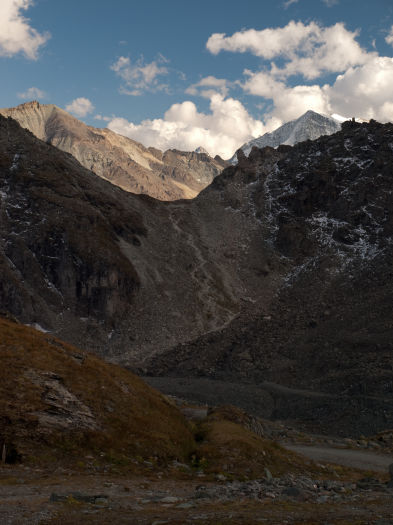
We ascended the steep Col des Roux (9,273 ft) quickly – it wasn’t too taxing first thing in the morning – and reached the sun-bathed summit by 8:30. The view from the summit was beautiful – below us was Lac des Dix still partially shadowed by the ridge to its east, and Mont Blanc de Cheilon gleaming in the distance. From this vantage point, our entire path up to the pass was visible; to top off the view, two Ibexes were climbing along the western ridge of the col.
The descent from the pass was very pleasant; the trail meandered through the tundra with lots of marmots chirping and scampering about. Near La Barma, the trail became a little confusing – there were a few different forks, all of which seemed to go in the same direction; either way, the direction to head was obvious. We quickly stopped at Refuge de la Gentiane La Barma as we’d seen the Brits and the tour group head this way. The refuge was empty, but a clearly labeled potable water spring was out front where we could've filled our CamelBaks had we not purchased water at the Cabane.
We reached the road at the lake’s shore about an hour and twenty minutes after reaching the summit of Col des Roux, just before 10am. From there, our pace quickened as the road was a nice and easy flat walk alongside the chalky white lake and a handful of cows. We managed to cover all 2.5 miles of road in about an hour before reaching the end of the lake and the beginning of the day’s real climb.
The trail broke into numerous braids and climbed steeply up the rocky terminus at the south end of the lake. After climbing for a few minutes, we passed the fork that lead to Pas du Chat
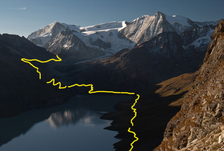
and continued on towards Col de Riedmatten. From there, it was only a short distance before we reached a small (but very sturdy) metal suspension bridge that crossed the stream leading down from Glacier de Cheilon above us.
Once across the bridge, the trail began to climb steeply again, gaining another 630 feet in 0.5 miles before leveling out briefly. Shortly after leveling out, the trail intersects with the scar of a landslide (mentioned in Stewart) which forces the trail to climb extremely steeply up the north side of the gouge in the hillside. The trail climbed 250 feet in 520 feet of distance (a nice 40% grade) along loose sand before cutting across the gouge and easing up. The hiking poles were extremely handy here as the loose sand didn't offer much of a footing. Lisa opted to semi-scramble using her hands to help with footing. Thankfully, the trail relented shortly thereafter and levels out a bit as it contoured the hillside. Update as of January 2014: This portion of the trail has been rerouted since we originally hiked it (thanks John Hendriks)
Eventually, the trail transitioned from a grassy hillside into a rockier wasteland (we arrived here about 1:30pm). Across the valley we could see Cabane des Dix perched on a black rock, overlooking the massive conveyor belt of Glacier de Cheilon. Shortly after entering the rocky section of trail we encountered a fork. A rock was painted with some letters on it, but it was too poorly painted to make out what it said. To our left the trail appeared to contour about a hundred feet higher up along the ridgeline – these were marked with blue blazes. To the right were the standard red and white blazes we were used to following, so we continued to follow them to the right.
The trail dropped about 100 feet down to skirt a section of boulders along the ridge. From there, the trail quickly regained its lost elevation via scrambling. Directly above us was Col de Riedmatten, to our right we had a clear view of the ladders (Pas de Chèvres).
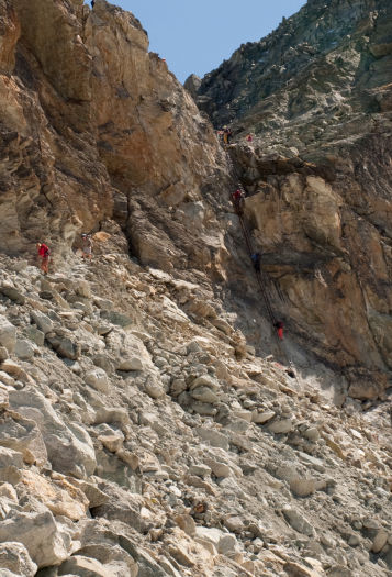
We began the day with intentions of climbing over the Col, but as we watched a few people climb the ladders, it really didn’t look too bad (this coming from a guy that had freaked out most of the day before). I had been anxious about the transition from the second to the third ladder but now that it was in view I could see that the ledge that you stepped over to looked relatively protected: it sloped into the rock face, offering more security for the transition.
The guide of the British tour group had indicated (after ascending the landslide gully) that the climb up the landslide gully was a “warm up” for Riedmatten (one of our friends that hiked the Haute Route called Riedmatten the scree chute of death...low praise indeed!). The footing along the climb up the gully made me quite anxious, and the idea of climbing another 300 feet up (and then down) something that steep didn’t seem particularly appealing – so in an impulse decision, we decided to tackle the ladders instead of the Col. By this point, we were directly behind the tour group (we’d been leap-frogging with them since Lac des Dix), so we parted ways once again to head over to the ladders.
The trail required some scrambling and was well marked with red paint. As we approached the cliff wall, the trail followed a series of narrow ledges amongst the boulders with occasionally fixed chains in narrower sections (the exposure didn’t seem to bother me as much as it had the day before - the drops here were not nearly as steep, but I still held on to the chains for dear life).
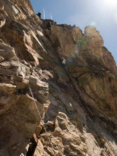
As we approached the base of the first ladder, the ledges became a bit narrower and fixed chains were connected all the way to the ladders themselves. There was just enough room to pass people coming in the opposite direction, and someone more sure of their footing wouldn’t need the chains.
We arrived at the base of the ladders at about 2:15pm. Unfortunately, a rather nervous (I’ve been there...) father and his 10 year old daughter (and a third man) were descending the ladders quite slowly. The group had opted to use ropes, which slowed them down considerably. Once the group was down (about 15 minutes later…lots of time to sit, hold tightly onto a chain, and think about what I was about to do) I started climbing first.
Since the base of the ladders was a narrow area that I didn't feel particularly comfortable removing my pack in, I had taken off my pack at a wider section of trail, stowed my camera inside the pack, and grabbed my gloves. Despite roasting in the sun against the white rock, the gloves proved critical on the ladders. The bottom ladder was an aluminum ladder attached to the rock face, but the top two ladders were both iron and in the shade so they were considerably colder to hold on to. Even with the gloves on, my hands started to get cold as I reached the top - I couldn't imagine this climb barehanded.
I completed the bottom ladder just fine, and it transitioned smoothly into the second ladder. The second ladder’s rungs were basically small iron bars, and the rock attachment points (large iron rods embedded in the rock that came out and around the rungs like hooks) occasionally jutted out
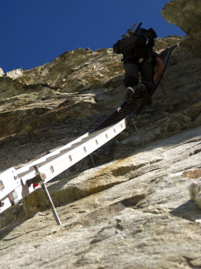
into the rung itself, making footing a bit awkward. My mental soundtrack was the following: “hand, hand, foot, foot,” as I slowly climbed one limb at a time. I didn’t look up or down, I just basically stared at my hands, the rock, and the ladder in front of me. It seemed like I had been on the ladder forever when I finally caught sight of the next ladder out of the corner of my eye; and someone starting to descend.
I said something to the two men that were starting their descent, and they were both able to move over onto the ledge such that I could pass them as I reached the top of ladder two. From the top of my ladder, I was able to easily reach over and grab a rung from ladder 3 with both hands, then step over onto the rock ledge, even with two other guys standing on the small ledge. Since the rock was sloped in towards the cliff face, it made footing quite stable as it forced you to lean into the ladder. As I started to climb the third ladder (probably about 10 feet?), I could feel a steady breeze coming down from the summit starting to lift my hat (and thinking to myself that if it went I would just let it go....); thankfully, I was nearly there. The top of the third ladder had a section of iron that extended along the right-hand side as a hand rail, plus a metal grate had been placed at the edge of the cliff face to facilitate easier stepping off from the ladder. It was easy footing to get off the ladder...And there I was...at the top! (9,326 ft)
The first thing I did was walk about five feet from the edge and sit down in the middle of a pile of large boulders at the top until Lisa made it up. She popped up a few seconds after I did and we celebrated on the top by eating fine Swiss chocolate. From the top, we could see the tip of the Matterhorn, just a few valleys away (the view from Riedmatten would have been better, but
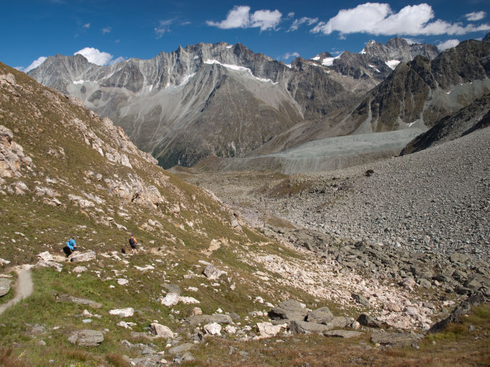
I was okay with where I was at). We started down shortly before 3pm. The trail down was steep, but very manageable. Much to our surprise we looked back and saw the tour group behind us, descending from the Col! Even with our break at the summit plus the delay in waiting for the group ahead of us to descend, we managed to beat them! We chatted a bit once they caught up with us; when I asked one of the group members how the Col was, his description was a quite sarcastic “exhilarating!”
After the ladders, the rest of the trail seemed rather dull and unexciting. Despite all of the excitement and anticipation of the ladders, we still had a long and tedious descent down into Arolla. Once down from the pass, we had a great view of the Tsijiore Nouve glacier and its lateral moraine to our right before the trail turned to the north and tipped into the valley. As the trail descended, the route became a bit tougher to follow – we had to pay close attention to paint blazes on rocks to avoid following the (much longer) road down the mountain.
We reached a small food stand at the base of the steeper part of the trail around 4:45pm; from there, we followed the road into the outskirts of town (the trail was hard to follow here...I continued to follow the GPS since signage was fairly poor in this section), before departing the road for a short stretch of trail one last time. We arrived in Arolla at 5:15pm that day – another long day of hiking!
As we entered town, we encountered the tour group once again (who once again leap-frogged us) enjoying a drink in the sun on a restaurant patio (they were waiting for the last bus of the day to take them down to their campsite in Les Haudères). We had not made reservations in Arolla, so we first popped into Hôtel du Pigne d’Arolla on the edge of town (one of our friends had stayed here on their journey) but they had no rooms available.
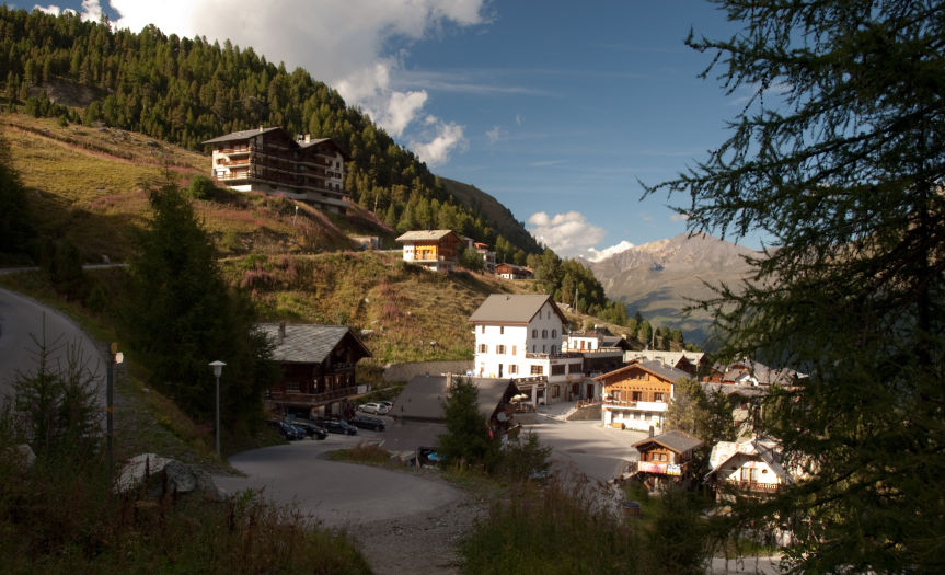
Next, we tried Hôtel du Glacier just down the street and thankfully they had rooms available. For 148 CHF we got a spacious room with a king bed, a double bunk bed, a small porch, a shower, plus a buffet breakfast.
Once we showered and did some much needed laundry, we wandered the town which basically consisted of two grocery stores, a sporting goods store, a bus stop, and two hotels with restaurants. We checked out the restaurant at Hôtel du Pigne d’Arolla, but it seemed a tad on the pricey side, so we opted to have dinner at our hotel – which was delicious! Between our broken French and their broken English, we managed to get by just fine! Incidentally, the Welsh couple, the Kiwi, and the Belgians all ended up staying at the hotel with us (we never saw the Brits again – presumably because they continued down to Les Haudères to gain some distance on the next day).
Day 7: Rest Day – Arolla to Les Haudères via Bus (September 5, 2010)
Breakfast at Hôtel du Glacier was a buffet with meats, cheeses, yogurt, and of course, bread. After 5 strenuous days of hiking, we’d decided to take a rest day. It was painfully obvious that we’d go crazy if we stayed in Arolla all day since there was little
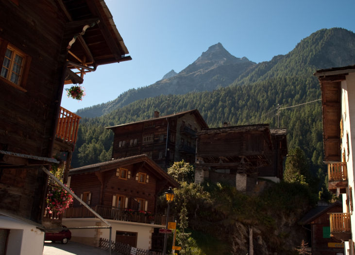
to see or do, so we decided to catch the bus down to Les Haudères. We came to the late realization that, since it was a Sunday, the bus came at 10:10am or 3pm…so we quickly packed all of our things (which we were getting pretty good at by now), checked out, and ran to the bus stop, just catching it in time.
The drive down to Les Haudères was exciting! In turns, the road was wide enough to accommodate the bus and maybe a tiny car passing; at each curve (and there were a lot as the road contoured the side of the mountain), the driver would honk his horn. The horn was perhaps the most entertaining part of the ride, since it didn’t sound like a bus horn but rather much like a series of alpine horns being blown (think Ricolla ads).
Once we arrived in Les Haudères, we wandered around the small town (huge compared to Arolla, but still pretty small) looking for a hotel. After checking out a few different places, we settled on Hôtel Les Mélèzes, a nice looking hotel just off the main road. We ended up with a small but nice room with a shower for 120 CHF. Since it was still early in the day, the owner let us drop off our stuff while they finished cleaning the room. With a lighter pack, we wandered the streets of Les Haudères trying to solve our next dilemma: it was Sunday, most of the shops were closed, and we were really low on supplies (plus we were going to another Cabane the next night, so no opportunity to re-stock there). Thankfully, after wandering the entire town, we found a single bakery that was open near the bus stop (a baguette for Brian), a cheese shop that was minutes away from closing, and just as we were about to give up, a grocery store on the north side of town that was open (in which we ran into some of the tour group folks). Once we had our supplies squared away, we were presented with another challenge: we had just barely enough cash to pay for Cabane de Moiry the following night and the town had no ATM (a fact confirmed by a local waitress). If we wanted cash, we’d have to take a bus two miles down the valley into Evolène. We decided that we’d just be careful in spending, using only our credit card in town. (It turned out that Cabane de Moiry took credit cards, but if you need cash, plan ahead, because there’s none here).
(Note: the town has a number of potable water spigots to refill water bottles – the water is very white and has a hint of sparkle, presumably from the fresh glacier run-off).
We had dinner at Hôtel Edelweiss (Rösti, sausage, and wine - 52 CHF) which was quite good (although just about everywhere in town had the exact same prices for food).
Day 8: La Sage to Cabane de Moiry via Col via Col du Tsaté (September 6, 2010)

Breakfast in our hotel in Les Haudères consisted of an extensive buffet of cereal, meats, cheese, breads and fruits. We were catching a an early bus, so we had asked the proprietor if we could dine earlier than the normal 8am and he was happy to oblige.

We knew the day had a significant amount of elevation gain ahead of us (5,600 ft) so we decided to skip the 1,000 foot climb from Les Haudères to La Sage and catch the 7:50am bus out of the center of town. It cost us a total of 6.80CHF to ride for 5 minutes, as opposed to hiking for an hour...well worth the expense! As we departed from the bus stop, we were greeted by one of the Belgians who had injured his knee and was taking a rest day in La Sage. We realized at this point that the Haute Route really was a small community - if you meet someone along the trail, odds are you'll see them at least a few more times in a small town or along the trail again. We started down the trail out of the center of La Sage at 8am – it started by climbing a dirt road southward out of town which became steeper and steeper as it switchbacked under an old chairlift while crossing a few pastures.
After an hour and a half of hiking, we reached the small village of Le Tsaté . The views behind us of Pigne d’Arolla were fantastic – ahead all we could really see was more grassy hillside. From Le Tsaté , the trail continued to climb at a steady grade through the meadow ahead. We were definitely in a cow pasture (the cows surrounding us and staring curiously at us was a big giveaway...but so were the cow pies), so paying attention to our foot placement became a bit of an important detail. The trail became faint at times, eventually giving out completely; we found ourselves consulting the guidebooks a few times to ensure we were on the right path. Midway up the hill was a small abandoned outbuilding just below a small road – we aimed for that since Reynolds’s book describes, “a solitary hut just below another section of unmade farm road.” From the hut, faint trails led out in a few directions – we followed a trail to the left which eventually intersected a solid trail that turned right and carried us up and over the bench above us to Remointse du Tsaté (10:30am).
From the Remointse du Tsaté the pass was still not visible. We could see another ridge crest ahead of us but realized it was too close to be the Col. We continued up the trail, passing a small tarn on our right. At 11am, we were finally able to see the summit of the pass in the distance.
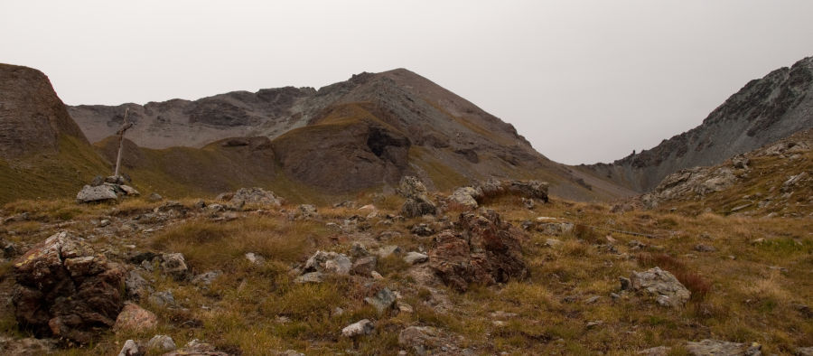
on the right
A few trails seemed to pick their way through the increasingly rocky landscape and all were well marked. Once we could see the signpost on the summit of the Col there was no question as to where we were going. The trail gained elevation at a very consistent grade up the rocky valley.
We reached the summit of Col du Tsaté (9,405 ft) at 11:45am. Behind us was a grand view of Pigne d’Arolla and Mont Blanc de Cheilon. Ahead of us, on the other side of the col, we could see a non-descript ridgeline and a silt settling pond below a glacier; the valley walls prevented us from viewing much else. We stopped for about 40 minutes on the summit of the Col to eat lunch while enjoying chamois scampering across the rocky hillside in front of us.
At 12:20pm we began our descent from the Col. The trail switchbacked tightly down a rocky hillside with slick footing due to the bare dirt and incline. After about 20 minutes, the rocky terrain yielded to a grassy alpine meadow, but the steepness did not abate. As we descended,
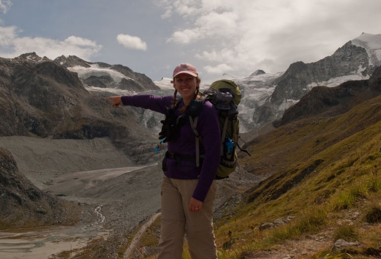
we could see more of the trail across the valley as it climbed to the cabane along the lateral moraine of Glacier de Moiry, but the glacier was still not visible. Once we reached a small tarn perched on a grassy bench (around 1pm) the glacier finally swung into view ...after which we simply couldn’t take our eyes off of it! What the rest of the valley lacked in terms of exciting views (at least that we could see from here) was entirely compensated by the glacier itself, and the path it carved through the rock. Across the valley, we could see Cabane de Moiry perched high above the glacier…tantalizingly close, yet still hours away. 800 feet below us, we had a clear view of Parking du Glacier with a few dozen cars parked in it (which gave a good sense of scale since nothing else in this valley really helps you appreciate the size of anything!).
The trail turned down the valley to descend down to Parking du Glacier. In this direction, we had unobstructed views of Lac de Moiry – a lake that is so unnaturally light blue that it boggles the mind! We reached Parking du Glacier at 1:35, taking a quick break and advantage of the public restrooms located there before re-ascending the opposite side of the valley.
The trail to the cabane had more people on it than any other trail we’d been on in days. Once we had reached the cabane, this theory was confirmed by the number of people up there to enjoy a nice lunch or some hot chocolate. The trail was well worn due to the high traffic as it climbed slowly up the far side of the valley, eventually reaching the crest of the glacier’s lateral moraine.

towards Cabane de Moiry
From there, you could opt to hike along the top of the moraine (which fell away quickly on both sides) or stay low on the left-hand side between the valley wall and the moraine itself. There was still a bit of snow on the left-hand side of the moraine, so this route may only be passable a few months out of the year. The trail along the lateral moraine was more defined and easier to follow (it only stayed on the very top for a few hundred feet) but it was decidedly more airy. Surprisingly, the height of this trail didn’t faze me nearly as much as Col Termin had!
The trail eventually hit the rocky outcropping on which the cabane was perched 900 feet above, meaning the trail had to start climbing. We began climbing the switchbacks at about 2:45pm. They were very solid switchbacks with a steady grade (not too steep, surprisingly). It was easy, however, to occasionally miss a turn or end up on a false trail which made the climb a bit harder. It was obvious that these switchbacks had been graded to accommodate the many day-trippers as they were not of the standard “Swiss” standards we’d come to expect (i.e. steep and abusive) but more “American” flavored (i.e. lazy and easy). The trail had no exposure but did require a little easy scrambling in particularly rocky spots. The biggest problem I had was keeping my eyes off the glacier below us – the dirt striations in the ice and snow far below gave me vertigo as I climbed!

We reached Cabane de Moiry (9,264ft, 160 CHF half-board) at 3:25pm. Based on other trip reports I read, I was expecting a relativity primitive cabane with an outdoor outhouse and no running water. Our first view of it was what we expected: stone building, metal roof, painted shutters; but as we walked around it we realized that this was no ordinary cabane (is there such a thing as an ordinary cabane?) – attached to the stone building was a huge ultra-modern style copper and glass clad building! This was no primitive cabane anymore! It was the result of a two year renovation that had opened for the first time this season, adding a huge kitchen and dining area with floor to ceiling windows overlooking the glacier below, modern bedrooms, indoor bathrooms (and showers), and the capacity to sleep 110 comfortably.
The cabane host showed us to the mudroom to remove our boots (the mudroom, which was probably the old dining area of the original cabane, was fully stocked with hundreds of brand new Crocs (branded with the Swiss Alpine Society logo) to use as hut shoes) and showed us to our semi-private room. The smaller rooms (as opposed to the dortoir rooms, which were in the old cabane) were on the second floor of the new “wing” – we had a narrow room that could sleep 4 in two head-to-toe bunk beads (we ended up having the room to ourselves, as the hut only had about 30 people that night). We had a narrow floor-to-ceiling window which overlooked the glacier, plus a panel next to the window that we could open for fresh air, a bench the length of the narrow room, an electric overhead light (no power outlets) and a set of shelves and hooks on which to hang our gear.
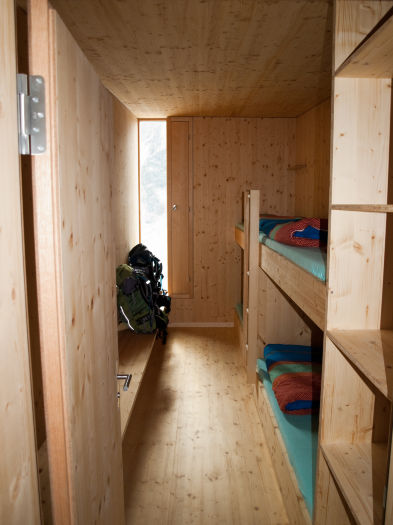
Once we changed, we explored the cabane a bit more. The old cabane held the dortoir rooms and the mud room while the new wing held the small rooms, dining area, a drying room in the basement and restroom facilities. There were individual bathrooms as well as a sink/shower room (showers for 5 CHF). Out in front of the cabane was a large stone deck with picnic tables, but the best part by far was the dining area which offered clear views of the glacier below through massive windows.
Lisa mentioned to the host that she was gluten intolerant, to which the host indicated that it would be no problem – we were having risotto for dinner because apparently there were 3 others with gluten intolerance in the cabane that night. After relaxing a bit with few games of cards, most of the day-trippers had departed and dinner was served. We ended up sharing a table with Belgians and it was good chance to get to know them better. Dinner was delicious: vegetable soup, salad, risotto, and a pear dessert.
Day 9: Cabane de Moiry to Zinal via Col de Sorebois (September 7, 2010)

Breakfast in the cabane was very spartan: bread, yogurt and cheese with instant coffee (ugh...). The cabane did not have potable water, so we spoke with the hosts about our options. They sold 1.5 liter bottles for 8 CHF each (much like Cabane de Prafleuri) but they also brewed a tea in the morning for departing hikers and they would provide a liter of the tea to supplement our water. Right before we departed, they ran out of the tea that they brewed, so they brewed a whole new huge container.
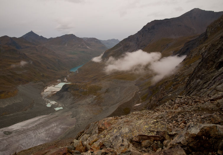
Lisa and I both filled up about 2.5 liters each in our CamelBaks before departing. Much to our surprise, it was a semi-sweet berry tea – a little unusual in taste (a few others we talked to hated the flavor) but the warmth and sweetness was actually kind of nice!
The clouds had come in in the night and it was raining lightly as we departed at 8:15am (our first day of rainy weather on the trail). We donned our rain gear and put on our pack covers as we began our descent. The sky was overcast, but the valley was still clear below us (for now). The trail started across wet rocks which were okay as long as we took them slowly. Thankfully, the gentle grade of the switchbacks down made them quite an easy descent in the damp conditions.
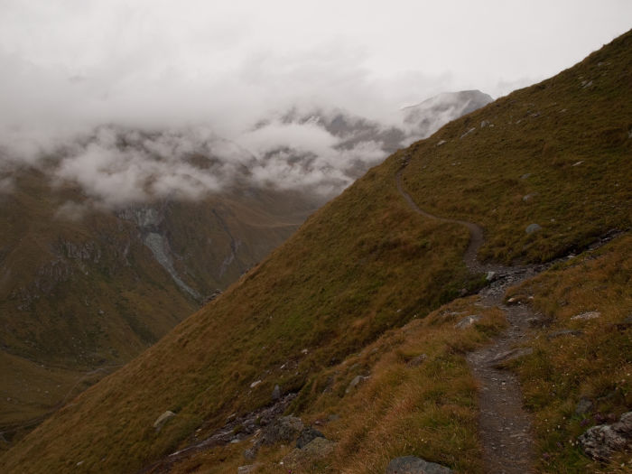
Thirty minutes later, we were down from the rocky outcropping and continued down the trail via the lateral moraine, backtracking down towards the Parking du Glacier. About a mile from the cabane (9:30am) our trail for the day departed the trail we’d hiked in on the day before and began to contour around the ridgeline to our right. Beyond the trail split, we continued hiking another 3 miles, gradually gaining and losing elevation as we followed the ridgeline high above the valley floor below.
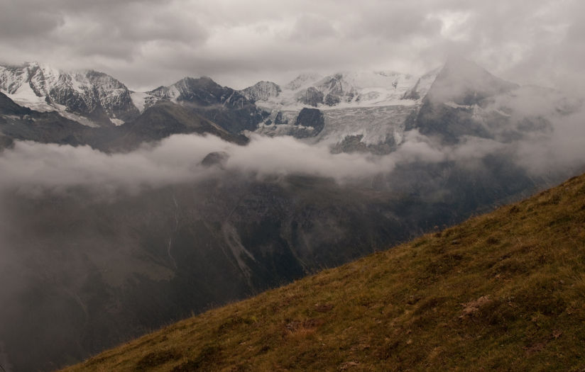
At this point, the fog had descended down into the valley and we could see 20 feet in front of us. All that was obvious to me was that the hillside fell away rapidly to my left, so I stayed as focused as I could on the trail itself, and not how high up we were.
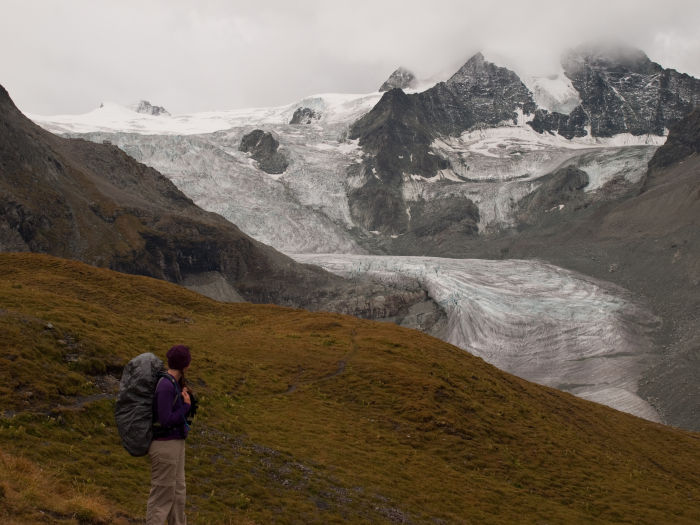
Occasionally the fog would break enough for us to make out the brilliant blue color of Lac de Moiry below us, but generally speaking, we could see nothing! Along this stretch of trail, there was one section of fixed rope where the trail crossed an small eroded rocky gully.
The trail began climbing again around 11:30am (after dropping about 600 feet) just above Barrage de Moiry. We encountered a set of signpost and a set of switchbacks (both barely visible in the fog) and followed the sign towards Sorebois. The trail, at times, became a bit faint in the fog but we were able to stick with it. We gained the summit of Col de Sorebois (9,298 ft) at 1:00pm – unfortunately, I can’t describe much of this trail because I couldn’t see anything except what was below my feet!
The clouds broke a little at the summit of the Col and we could make out some of the ridgelines surrounding us, and see some of the ski area below us on the other side of the Col. We continued to descend in heavy fog surrounded by sheep and cows and ski lifts. We reached the Sorebois Cable Car around 2:00pm, about 1.6 miles from the summit. We fully intended to make use of this mechanized transport to get us to Zinal below but our hopes were dashed when we found it to be closed! We were in the shoulder season where they only operate it on select days of the week...and today was apparently not selected (as of 2010, it’s closed on Mondays and Tuesday in September).
Disappointed, we continued to descend on the trail now realizing that we had 2.2 miles more to go with a steep 2800 feet to drop into Val de Zinal. Shortly after leaving the cableway station, the trail broke from the road – this departure was not very obvious as the sign indicated that
both directions lead to Zinal (the route we took had the familiar red and white sign tip). Had we not departed the road, it would continue to descend down via switchbacks about half a mile south of Zinal (this is the route the Belgians ended up taking down); this may have been an easier descent, but longer.
The trail dropped gently through meadows via long switchbacks as the hillside began getting steeper and steeper. Eventually, the trail led into a forested section (3:30pm) of the hillside…then it got steep. Really steep. Hella steep. The trail tipped to a 40% grade, dropping 800 feet in a third of a mile. The forest floor was also slick underfoot (the small pine needles acting much like ball bearings), making the descent that much more difficult. The trail eventually leveled out, crossing a wood bridge and dumping us into the town of Zinal at 4:30pm.
We had no reservations for lodging, so we popped into the tourist information office on the north end of town. They were very helpful and spoke English, making our conversation a bit easier – they indicated that the cheapest hotel in town with en suite bathrooms was Hôtel La Pointe de Zinal, located just next door.
Just outside the tourist office was an ATM (the first one we'd seen since Champex), so we replenished our cash supplies and headed over to the hotel. We asked (in French – from what we could tell, they spoke no English) if they had rooms. We ended up with a fairly spacious (albeit weirdly laid out) room with a (super tiny) bathroom for 157 CHF. Just as we checked in, it started to rain for the first time since we left the cabane that morning.
After we showered (the shower was very powerful and felt wonderful!) and the rain stopped, we wandered through town. The entire town was about a half mile long, and on the southern end there a number of old buildings constructed around the early 1800s. As we walked, we ran into the Belgians and the Kiwi again! We opted to have dinner across the street at Europe Hotel where I had Penne Arrabiata and Lisa had Lamb Steaks for 68 CHF (with wine, of course). Ironically, sitting across from us once again were the Belgians and the Kiwi (plus some others that were staying in the dortoir with them).
We awoke the next morning to rain and fog. We still had another day of margin in our hiking schedule (with only two days of hiking left) so we decided that we would take another rest day to see if we could wait out the weather.
One of the key reasons we were doing this hike was for the views, and both of us were bummed that our hike into Zinal was so cloudy and foggy. (Plus, our legs still felt a bit like jelly from the descent down from Sorebois.)
We went down to breakfast, which was a very elaborate buffet of many juices, coffee, ham, cheese, fruit, yogurt, bread as well as the best, and I do mean BEST, croissant I’ve ever had. Let me reiterate that: the croissants were absolutely amazing! Afterwards, we asked the hotelier if she could put us up for another night – she checked, and said it wouldn’t be a problem...so we enjoyed a rest day in Zinal.
All of the lunch menus seemed rather heavy (and pricey) so we decided to pick up some meat, cheese, fruit, and bread from the supermarket for lunch. The day cleared up a bit in the valley (although clouds were still clinging to the ridgelines) so it was pleasant enough to meander through town. We stopped into the two sporting goods stores to look for replacement sunglasses for me (mine met an untimely end along the trail a few days before) but couldn’t find anything quite right. While we explored, we ran into the Welsh couple we shared a room with in Cabane de Prafleuri and caught up with them a little.
For dinner, we dined on fondue and saltimbocca (and wine) at Le Fermi for 67 CHF.
Day 10: Zinal to Grüben via Forcletta (September 9, 2010)

Restless from our rest day, we were anxious to hit the trail. Following another delectable breakfast of croissants (and a buffet) at Hôtel La Pointe de Zinal, I walked next door to the bakery to pick up a baguette for the trail and we were off at 8:15am (both the bakery and the supermarket opened at 7:30am – plenty of time to stock up before hitting the trail).
We chose to head towards Forcletta (the pass) and Grüben rather than Hotel Weisshorn (neither of our two friends that had hiked the Haute Route had said that Hotel Weisshorn was particularly amazing, so we chose to skip it and save a day). Before departing from the hotel, Lisa asked the innkeeper (in French) if she could call Hotel Schwarzhorn to make a reservation for us, since lodging in Grüben is very limited.
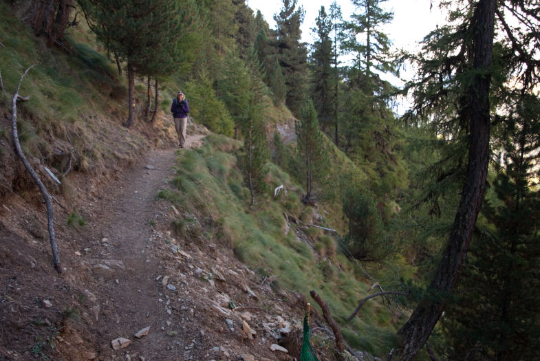
We set off through town in search of the trail. We found ourselves relying heavily on Stewart’s book to help us up and out of town on the right road. Once out of town, the trail was obvious and climbed steeply gaining 1,300 feet in just over a mile. After this steep gain, the trail leveled out as it contoured the steep hillside and headed north. As we hiked, we spotted Sierre-Zinal ultra marathon signs indicating the distance remaining to Zinal – obviously this was the route taken into Zinal by the marathon!
The path provided some fantastic views of the Val de Zinal behind us, but it was a narrow shelf along a steep hillside, which fell away rapidly to our left....I just tried to focus my attention forward and kept hiking. We stopped for lunch at the turn off for Alpe Nava at 11:30am. The air was still quite cool (we started in 42 degrees F), but the sun (when out) provided some nice warmth. We had gained 2,602 feet to this point over 4.2 miles.
From our lunch spot, the trail turned steeply up a hill towards Alpe Nava and became difficult to follow for a while. A stream flowed down what could have been a path, and there were a number of braided trails to pick from. We
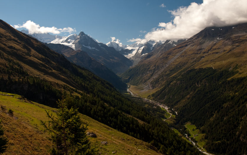
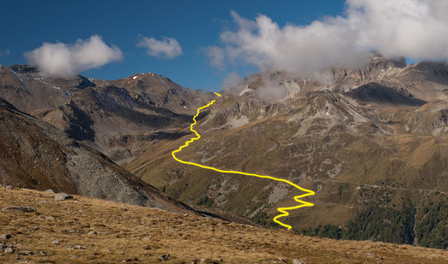
eventually found our way up onto a grassy bench and the path became obvious again. The last push to the pass was decent – the grading of the trail was reasonable and we made good time up the last 900 foot push with great views of Grimentz and Sierre far below us. We reached the summit of the pass (9,440 ft) around 1:15pm. From the pass, we could make out Augstbordpass across the valley – tomorrow’s conquest, but little else. By now, it had clouded over and was a bit breezy on the pass, so we opted to just press on rather than taking a break at the top.
The other side of the pass was desolate and rocky, offering little in the way of views other than a small section of ridge across the Blüomatttälli valley. As we descended, the small side valley we were in began to open yielding views of the Turtmann and Brunegg Glaciers to the south, and eventually Grüben. We stopped for a snack in a meadow while we were pelted with occasional snowflakes (the temperature, with the wind chill, was probably right around freezing).
As we descended around Chalte Berg, we lost the trail and ended up following a false spur that contoured around to the north instead of dropping down to the road. Eventually, we realized we were off track (consulting Stewart for guidance) and
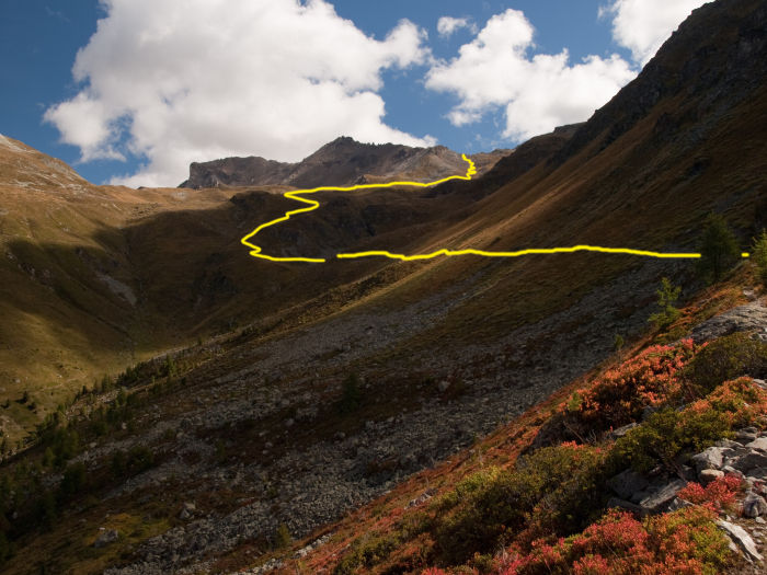
dropped down into the meadow below, eventually spotting a familiar red and white blaze on a rock in the meadow until we reached the road. In this valley, the blazes were all quite faded, and even the signage was peeling and fading. We followed the slightly overgrown and poorly marked trail (this was probably the hardest section of the hike to follow – obviously not as frequently traveled as other portions of the route) until it departed from the road and began to switchback more steeply down into the valley.
As we descended to the valley floor, it felt much more like fall than it had so far along the route. We were no longer hiking through lush green hillsides, but rather golden meadows with trees turning shades of red and gold.
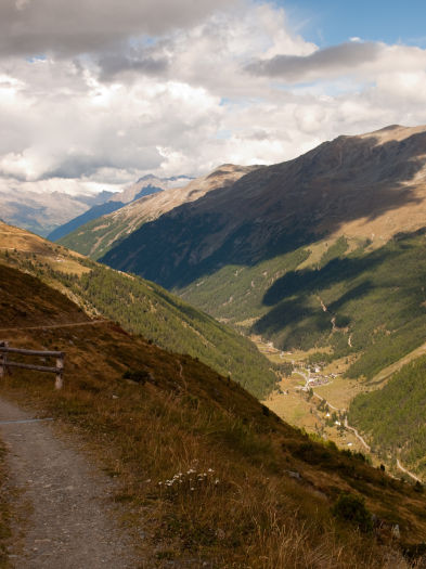
The colors fit the overall cool feeling of the day and made the hike enjoyable in a different way than the previous days had been.
We reached the valley floor around 4pm, popping out into a small farm. We left the farm and tried to follow a trail on the west side of the river but it proved impassible. Instead, we backtracked to the road that crossed over the river and followed it into town. (In consulting the maps, it appears that the real trail was a few hundred feet to the west of the river and we missed it because we left the farm...but walking on the road actually felt quite nice on tired, aching feet.)
At 4:45pm, we arrived in Grüben. Finding Hotel Schwarzhorn was easy – it’s the tallest building in town; in fact, we were able to spot it from the trail 2,000 feet above the valley. We were a bit anxious as we approached the front desk – we were now in the German-speaking portion of Switzerland (and my German is VERY weak). As we checked in at the front desk, we were pleased to learn that, although the innkeeper spoke no English, she spoke French, so Lisa handled our check-in (An important note: Hotel Schwarzhorn does not take credit cards...and forget about finding an ATM in town).
Our room (180 CHF half board) was decently spacious in the corner of the hotel, looking north and west, with two twin beds pushed together (with the standard down comforter on each one), two small closets, a few electrical outlets, and a sink. The (recently remodeled) bathroom was down the hall with additional sinks, showers (they provided shower gel and towels), and toilet stalls.
Dinner was served from 6:30pm to 8:00pm; after showering and recovering from the day, we headed down for dinner where we met our first American of the trip, from New York City of all places. Shortly after sitting down, the Kiwi we met back in Cabane du Mont Fort came down for dinner (between rest days and trips out to other huts, somehow our schedules had re-aligned). The waitress that seated us spoke perfect English and they were able to easily accommodate Lisa’s gluten intolerance. Dinner was a vegetable soup; mixed vegetable salad; pork roast with carrots, noodles (substituted with potatoes for Lisa), and gravy; with crème caramel for dessert (Lisa dessert was substituted with fruit cocktail) . It was wonderful!
Day 11: Grüben to Jungen via Augstbordpass (September 10, 2010)

Breakfast was available starting at 7am. It was an extensive buffet with bread, cheese, yogurt, cereal, meat, coffee and juice. Once done with breakfast, we were ready to hit the trail – which was just out in front of the hotel.
I was anxious about this day of hiking; I knew there was a section of exposure as the trail neared Jungen and I was not looking forward to it. Realizing, however, that it was followed by one of the best views on the trail (and that we had little other options for getting to St. Niklaus) we pressed onward.
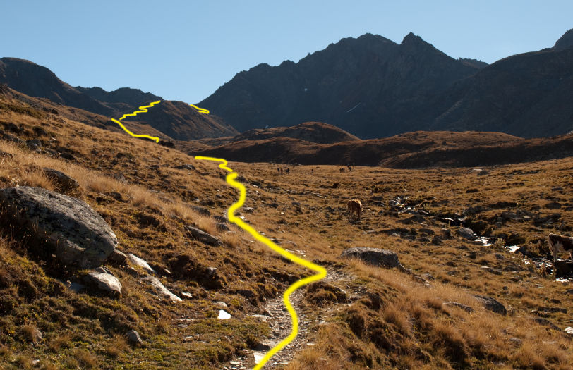
We started hiking at 8:20am. The trail started just outside the dining area of Hotel Schwarzhorn and didn’t waste any time climbing. It was a cool crisp September morning, so the climb helped us warm up quickly. As we ascended, we occasionally caught views of the Rhône valley far below to the north, through the trees. We reached tree line around an hour after setting out, and passed a small farm about half an hour after that (where Lisa finally decided it was time to pet one of the many cows we'd seen along the trip). Past the farm, the terrain leveled out a bit and we finally caught sight of Augstbordpass in the distance. The trail still climbed steadily, but now without the need for switchbacks.
The terrain changed from alpine meadow to rocky as we neared the pass. Just below the last push towards the summit, the trail contoured around a rock fall, requiring a bit of scrambling around the massive boulders, then climbed steadily towards the pass summit at 9,494 feet. We reached the summit of the pass at around 11:40am after climbing 3,540 feet in 3.3 miles.
We savored our last summit of the trip as much as we could – with sort of a love/hate relationship; we’d crested a total of 9 passes on our journey and despite the amount effort required to reach each one, the views were truly amazing at each one. The view from this particular pass was not that spectacular; the surrounding peaks (coupled with low clouds) blocked most vantage points which just left the rocky valley below that led us to the larger Mattertal valley. Plus, it was really cold!
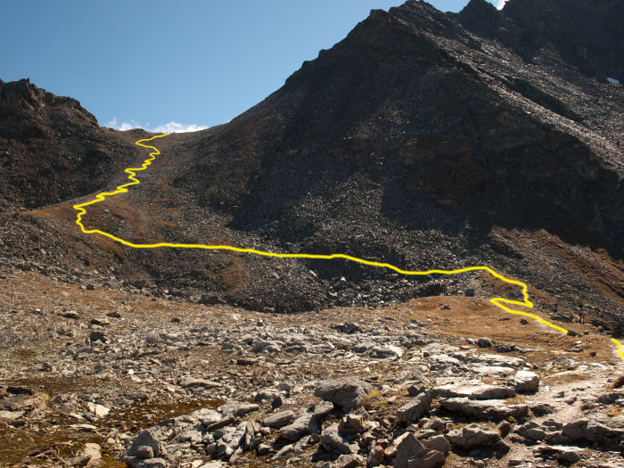
The steady breeze we’d encountered as we climbed towards the summit turned into a steady wind at the top of the pass. Thankfully, just a few feet below the summit, a pile of rocks offered nice shelter from the wind where we could enjoy our lunch of cheese, sausage, bread, and chocolate. After taking a 25 minute lunch break, we began our descent down the steep rocky trail. The trail snaked down the valley as the valley choked down, at one point through a narrow slot between massive rocks. Past that choke point, the valley opened up significantly and we could finally start to see the other side of the Mattertal valley (however our viewpoint was still constrained by the ridges on both sides of us…and clouds).
Eventually we encountered a trail junction point which pointed the way to Jungen. On of our friends who had done the Haute Route before (in June) had opted to continue straight and drop into the valley via an alternate route (to avoid lingering snow). Based on their description, it involved contouring around a cliff by way of wooden planks bolted to the rock face...that sounded even less appealing than the exposed trail we were heading to. Instead, we followed the trail to the right (which is the
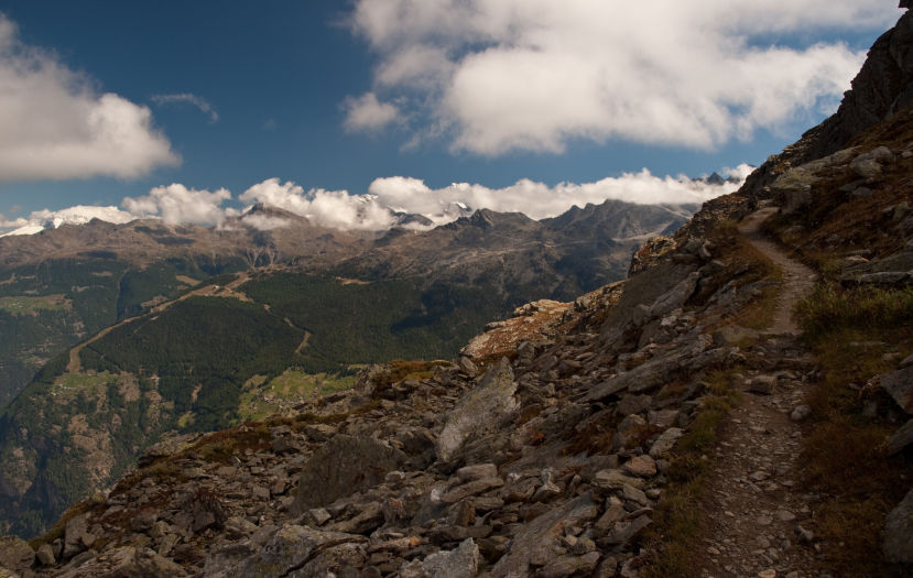
standard route) and began to contour along the ridge to our right, climbing steadily as it contoured. At this point, I began getting a tad nervous – based on trip reports I’d read, I knew that there was more exposure coming, and it was at the end of this ridge. The trail climbed gently as the valley floor fell away dramatically below, yielding amazing (albeit vertigo inducing) views.
Eventually, as I knew we would, we ran out of ridge to contour along and it was time to round the corner into the next hanging valley…this, as I knew beforehand, was where the trail was exposed. As we got closer, the trail became increasingly rocky as we were basically just hiking along talus. At 2pm, we reached the exposure. The trail was (thankfully) wider than on Sentier de Chamois and offered steady footing; at one point, some trail erosion required a little scrambling around but not in a terribly exposed section…beyond that, I can’t talk to the exposure level as my eyes did not deviate at ALL from the trail until we reached the terminus of the ridgeline (where the exposure ended). I’d say it was about a minute or two in total…but how should I know? I was just staring ahead and didn't look down once!
All I can say is that, when it was all over, it was so worth it. Once we reached the end of the ridgeline, the Mattertal valley came completely into view…and what a view! Smack in front of us, dominating the view was the Dom. 5,000 feet directly below us was St. Niklaus (and Jungen). This truly was one of the most amazing view on the entire hike (and worth delaying the extra day in Zinal for).
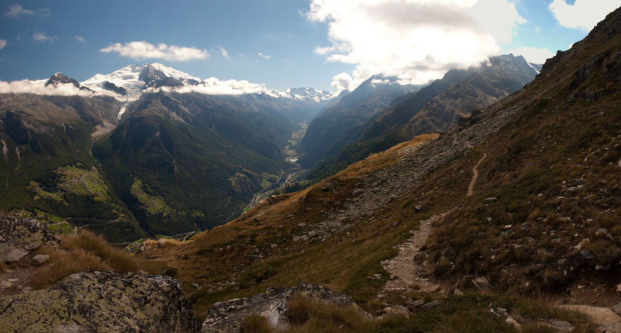
We took the obligatory photo of the two of us with the Dom in the background, then continued on down the trail. From here, it was all downhill. Thankfully, the wind had abated quite a bit and, as we descended, it became quite warm. We dropped quickly down a long switchbacked trail with no exposure (thankfully)…however the view down the hill was still a bit vertiginous for me. Our trail eventually intersected Alpineblumweg, which was a wide alpine flower trail that contoured along the valley and eventually dropped into Jungen. We arrived in Jungen at 3:40pm.
We had decided to take the cable car from Jungen down to St. Niklaus and avoid another 3,000 feet of steep descent - this made Jungen the end of our Haute Route hiking. There were a number of people lingering around Jungen, but we decided to head straight for the cable car (I was concerned that they were going to close at 4 or 5pm - I think they're open until 7pm or so). The cable car was self-operating (sort of) in Jungen. We hopped into the tiny car with a German couple who used the intercom system to communicate to the lift operator down below. The car itself sat 4 (it was basically a small chair-lift sized gondola car) and had exterior shelves for packs, since you really can't fit in the cabin with your pack). After a few minutes of awkward waiting in the tiny car (not knowing when it was going to move), it finally
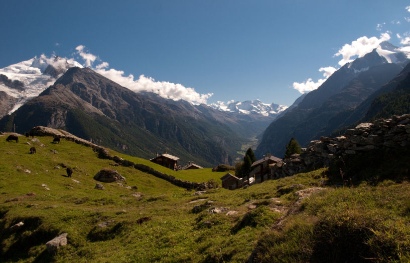
departed with no warning. I had thought the exposure on the trail was going to be the scariest part of the day. I was wrong. This tiny cable car descended silently down the steep hillside into St. Niklaus 3,000 feet below. Honestly, it scared the crap out of me - the car seemed sturdy, but we were REALLY high up and we were crammed into the car! To make matters worse, about 1,000 feet above the town, the cable car stopped for about 5 minutes and just swung silently in the breeze (presumably to allow people to get on at the mid-load point in Jungen…don’t even get me started on what the mid-load point looks like…). Update: For those that plan to continue hiking from here, the route from EuropaHutte to Zermatt was closed as of September 2013. Be sure to get updated information before attempting that route (thanks John Hendriks).
Of course, we survived the cable car with no issues. We paid the lift operator once we reached the bottom (don't recall the cost of this lift) and waited for the 5:10pm train to Zermatt (32 CHF for both of us).
Once we arrived in Zermatt we hit sensory overload. We had gone from the solitude of alpine hiking to a bustling train station and town jam packed with people; more people than we’d seen in any of the towns we’d been in over the past two weeks. It took us a few minutes to acclimate to the humanity around us. We stopped in to the tourist information office in the train station to phone the hotel we stayed at 5 years before (Hotel Alpenrose) to see if they had any available rooms, which they did. The hotel was at the far end of Zermatt, so we began to walk (through the crowds) to our final destination. Amazingly, as we strolled up the street, we ran into 3 hikers from the UK Tour Group we’d been leapfrogging in the first few days. Shortly afterwards, we ran into Gerard (from the Belgian group) and talked for a few minutes (again - it's a small community of folks on the trail!)
We stayed in room #1 at the hotel (which I recommend) which has a fantastic view of the Matterhorn from its sun drenched porch (210CHF/night). The hotel was as we remembered it – modern and nicely appointed. That night, we dined at Whymperstube…another favorite from 5 years before.
Overall Thoughts
We finished off our hike with a day of relaxation in Zermatt, hiking around Sunega Paradise, and just soaking in the views. Afterwards, we caught a train down to Cinque Terra in Italy for some quality beach relaxation. On the train, I wrote down the following random thoughts and observations.
- I wasn't nearly as sore or tired at the end of the hike as I had expected to be. The first three days were tough; despite our training in Colorado (there's really nothing that compares to hiking in the Swiss alps). Surprisingly, after a few days of hiking, we really got into the groove of things and felt really very good at the end of the hike.
- Most of the hikers on the trail were older than we expected – early 50’s maybe? …but they were almost all FAST!
- Speaking a little French was helpful, but even without it communication was still very possible
- Lisa’s gluten intolerance turned out to be non-issue at all; everywhere we went they were able to accommodate it (or she could selectively avoid it). Speaking French probably helped more here than anywhere else, but Lisa had also found a few pre-printed cards that explained Celiac disease that she could fall back on if necessary.
- There was more exposure along the trail then I expected; most people probably wouldn’t care…but I noticed it
- We were always unclear on how safe it was to drink glacier water. From our experiences hiking in Colorado, we have to filter any stream water; for this reason, we avoided any stream water in Switzerland (even glacier meltwater). We overheard a guide in Cabane de Moiry indicate that some people can drink glacier melt water just fine, and others cannot…probably best to avoid it (we’re glad we did).
- Having a water filter on the hike was not necessary, but we each carried about 3 liters of water a day; a filter would have saved us some money at the cabanes where you had to purchase drinking water.
- We both hiked with 3 liter CamelBak bladders and found them to be the perfect size – we didn’t have to worry about refilling them (however, there were plenty of streams which you could filter water from)
- It was good to start seeing familiar faces along the trail or at the cabanes – we did get to know our trailmates.
- Hardest stage: Fenêtre d’Arpette – it’s hard to say if this was difficult because it was early on in the hike (and we weren’t quite up to shape yet) or because it was a lengthy, steep climb with a lot of distance.
- Second hardest: Cabane du Mont Fort to Cabane de Prafleuri – the numerous passes on this hike (including the highest pass along the trail) really stretch it out, plus you’re still an hour or so out once you begin your descent of the last pass.
- The trail was usually very easy to follow; in a few spots it was faint (more towards Zermatt) but these were well indicated in the book(s) and a good map/GPS would make light work of the route finding.
- The other self-guided hikers on the trail with us regularly had their guidebooks in hand along the trail – we found this unnecessary (however I did regularly consult my GPS); having the guidebook in a handy exterior pocket was useful for the occasional consult, but the trail and signage was usually very clear.
- Having a GPS with the route programmed in (which is my typical method of backcountry travel) was nice, but not necessary. (You can download the route at the links below)
- Lisa found her sleeping bag liner (Sea to Summit Reactor Thermolite Mummy Bag Liner) to be perfect along the trail. The standard Swiss bed makeup is a bottom sheet and a comforter – Lisa enjoyed the extra layer of “sheet”. I personally didn’t use mine except in the Cabane’s – mostly because I felt gross and sweaty and didn’t want to dirty their linens.
- It was important to plan ahead our cash supply – many of the small towns we stayed in did not have ATMs. Most places we ate and stayed took credit cards, but you could never count on it. Be sure to get cash (CHF, of course, not Euros) in Chamonix, Champex or Verbier, and Zinal.
- Carrying a second pair of shoes for town/cabanes was nice. Many others along the trail had tennis shoes as their secondary pair – we brought sandals; either worked fine (there were no stream crossings that required sandals, which was one reason we had them…just in case). Many cabanes had loaner shoes but they looked kind of sketchy.
- Hat and gloves were critical – many mornings and pass summits were very chilly
- If you like hiking poles, bring them. Most of the passes get quite steep and having the extra stability was critical. Lisa, on the other hand, hates hiking with poles and didn’t bring any. Most people on the trail had hiking poles.
- We saw maybe four other Americans along the trail…and even fewer signed in to Cabane log books. Most on the trail spoke English, but were not from the US.
- When we did the hike, reservations weren’t necessary anywhere along the trail; none of the Cabanes were more than half full and the towns had adequate lodging (but I’d still recommend it…just to be on the safe side).
- A deck of cards and a book were nice to have to kill time, especially in the Cabanes.
- As far as clothing is concerned, we both brought 2 pairs of hiking pants, 2 hiking shirts, 3 pairs of wool socks (and 3 liner socks), and a long sleeve shirt – this combination worked really well and allowed us to launder a set each night or go a few days without washing (at the cabanes) without any issues
- I also brought a pair of jeans and another long sleeve shirt – these are what I wore in the evening or around town and was a nice luxury
- Lisa had wished she had brought a second long sleeve shirt
- I also brought a day bag – a messenger bag that I rolled up and stowed in my pack. A lot of others on the trail had simple drawstring backpacks as their “day pack”. I used this after our hike in Italy and whenever we wandered around town (plus this was my carry on luggage for the flight over).
- We used two stuff sacks for clothes: one dirty, one clean (or one wet, one dry, depending on the day). This kept our clean clothes from getting all stinked up by our dirty ones
- When we first arrived, the weather was cold and rainy. Many people indicated that the weather was a bit unusual for this time of year. Our first day’s hike was cold and windy – we found ourselves wearing all of our layers for warmth (which worked perfectly). The weather gradually warmed throughout the trip and we found ourselves hiking in short sleeves (but still keeping the zip-off pant legs on our pants), donning warmer layers only at the tops of passes. We had a few rainy/sleety/foggy days where rain jackets were necessary (but no drenching rains that required our rain pants or pack covers that we had with us). The temperature in the evenings dropped down, perhaps to the low 50’s (F) and we found our long sleeve layers plus our rain jackets offered sufficient warmth.
- We purchased a 50 MB international data plan for Lisa’s iPhone (from AT&T) which was perfect; we used about 15MB to occasionally surf the web (for things like bus schedules), check weather, send emails, or re-read others’ trip reports while we were on the trail. Only 2 hotels along the route had Wi-Fi (Chamonix and Zermatt) but we had cell coverage everywhere except Cabane de Prafleuri, Cabane de Moiry, and Grüben (our signal was weak in Grüben…we could check email, but not make phone calls).
- Having both guidebooks was incredibly helpful – each had a slightly different perspective on the trails and accommodations. Like any guidebook, though, their descriptions made more sense after we finished hiking for the day. We tended to re-read the days’ trail description each night to see what we may have missed or to get a feel for the authors’ way of describing certain terrain features (like “spectacular balcony path” = “Brian has a mild coronary”). After re-reading the days’ route, we’d read the next day’s description – reading too far ahead just got us confused, so we avoided that.
To wrap it up, in case you haven't gathered already, this hike was amazing. Words really cannot describe the amazing views and the entire experience. After hiking for years in Colorado, I can easily say that nothing in Colorado compares at all. If you have the chance - DO THIS HIKE! I hope that this trip report provides some help in your planning and preparation. If you have any questions for me, please don't hesitate to email me at . My trip was made better by the reports that others took the time to write, which is why I offer this trip report to you! Enjoy!
Frequently Asked Questions
I've received a number of questions from folks that have read this page; I figured I'd post my answers in the hopes that they may help you!
I'm trying to shorten my trip - are there any stages that you wouldn't miss?
We cut out a lot of stages on our trip and I wouldn't recommend skipping any of the stages I listed above. That said, if you need a shorter trip or to cut out stages for time or weather, here were our most spectacular days that I wouldn't miss:
- Cabane du Mont Fort to Cabane de Prafleuri via Col Termin - this day scared the crap out of me (I'm not big on heights....I'm sure you gathered that already) but it was honestly the most amazing day of hiking. Note: this really forces you into the following day from Cabane de Prafleuri to Arolla, but that was an awesome day too...and also the Verbier to Cabane du Mont Fort - so this is kind of a three day commitment.
- La Sage to Cabane de Moiry via Col via Col du Tsaté - this hike was really nothing special until you get over the pass. Since the trail drops down to a parking lot, you could skip the Arolla to La Sage/ Col du Tsate hike entirely and just drive around to the parking lot. From the parking area, it's a 2 mile hike (I think) to the hut... DON'T MISS THIS HUT!
- Col de la Forclaz to Champex via Fenêtre d’Arpette - this was one of the hardest hikes (especially because it was early in the hike), but the view of the glacier was breathtaking
- Grüben to Jungen via Augstbordpass - the view on this hike was second only to Col Termin
I think those were our toppers.
Did you need an ice axe for any of the route? Kev Reynolds recommends one.
Not once did I ever see the need for an ice axe. I suppose that if you did this hike in the spring it could be handy, but in August the only snow you will cross is at the very top of Col de Louvie as you descend into the Grand Desert....and that was maybe 20 feet worth of snow.
Really, most of the snow had melted out and the only other snow we saw was glaciers...which, in my opinion, would've required a lot more than an ice axe.
You didn't use a tour company - was it hard getting rooms or following the route on your own?
We saved a significant amount of money going on our own, plus unlike the tour groups, we got our pick of lodging and dining....we stayed at pretty nice spots and ate very well (that's typically with a half bottle of wine with each dinner too).
For us, doing this hike without a guide was not a problem at all. There was a lot of upfront researching, but it's really well laid out in Kev Reynold's book, which I would buy if you haven't yet - he steps through each stage with turn by turn directions, available lodging in the area, and alternative transport. We used his book with my GPS (we had some poor maps as a backup to the GPS) but we rarely needed the GPS at all - it was just a nice safety net for when the trail isn't well marked or worn.
Lodging was easy to find in each town - whenever there was limited lodging (like in Grüben or at a hut) we'd call ahead the morning we departed to ensure we had a room waiting for us. Since my wife's French only got us so far, we usually asked the hotel we were staying at to call ahead for us. At every other town, we just showed up and hit the tourist office for info (or wandered to various hotels based on the description in Reynold's or Stewart's book). Two of our friends did this hike in July and they ran into some lodging issues (which they knew by calling ahead) forcing them to stay an extra night in the town they were currently in - doing this hike late in August or September should eliminate most, if not all, of the lodging vacancy issues. We encountered no issues in finding a room on our hike.
Personally, I think doing it without a guide was WAY better - we got to hike at our own pace (rather than stopping whenever the group decided to stop), we picked our own lodging (rather than camping or staying in large hostels), and eat where we chose to. We also were able to take rest days when we needed them (or when weather dictated). All of this was significantly cheaper than a guided tour. The only possible downside was that we had to carry all our gear (unlike the tour group that we kept leap-frogging on our hike, who traveled with lightweight day packs....ours were about 30-40lbs each).