Mt. Belford and Oxford
Some friends and I had decided that we wanted to hit one of the Collegiate peaks. One of my friends suggested Oxford, for which the easiest ascent route is directly over Belford. So that's what we did.
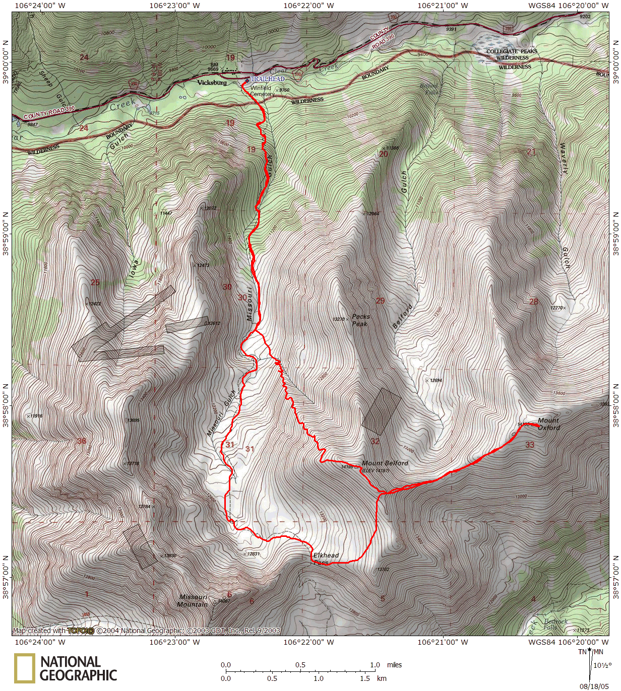
Coming from Denver, we stayed the night before in Buena Vista (the Super 8, to be exact), since none of us felt like camping. We left the hotel at about 6:00am and arrived at the Missouri Gulch trailhead around 6:30. I'd read in a number of places about suggestions to start this hike an hour before daylight, but this was about the best this group could muster.

With a chill in the air, we started hiking up the trail. Seeing as how I'd done Mt. Evans from Scott Gomer Creek the weekend before, anything that had a solid trail and no willows was fine with me. This trail was great - a nice gentle slope, and hey, no willows (at least down below).
Crossing the log bridge over the stream was, as always, an exciting proposition, but no huge problem. We ascended up the shoulder of Mt. Belford on the solid switchbacks (provided by CFI, I presume), summiting around 10:30am (we're a slow group of hikers). Surprisingly, we'd passed a few tents on the ascent, but the trail was mostly deserted, which is rare for a Sunday hike.
")
Anyway, we snacked a little, but then pressed on to our primary objective of Mt. Oxford. The descent into the saddle was pretty steep, but not a problem...clouds were starting to build up, which had us all a little worried, as there was absolutely no where to hide, and the way back was barred by a 14,000 ft peak! We hit Oxford about an hour later. The view from Oxford was great, but I still think the number of peaks visible from Belford is astonishing!
")
We trekked back across the saddle, down the gentle slope of Oxford and onto the steep upslope of Belford. Boy...we thought it was steep coming down! Our legs were certainly feeling the ascent back up Belford.
")
Deciding that we didn't really want to descend back down the switchbacks of Belford, we took the circuitous route down to Elkhead pass from Belford, which snaked us down through Missouri Gulch (and gave us a great view of Missouri Basin on the other side of the pass). This seemed a wiser move in case clouds continued to build and a storm swept in (as we'd be in a valley, rather than a ridge). In the end, the clouds never materialized into storms, and just occasionally provided us much needed shade for the descent. The Elkhead pass route ended up being far kinder to our knees, but it probably added about 2 miles to our trek.

After a long descent, we returned to the car around 5:00pm, thankful that we started as early as we did. My GPS claimed that we had done about 15.4 miles, which I tend to believe. The Elkhead pass added a good bit of distance, but was probably a bit more enjoyable, as we saw more of the valley. We took a chance to cool our feet in the icy water of the creek by the trailhead and headed home.
All in all, Belford was probably one of the more enjoyable hikes I've done; but its length would deter me from bringing along a beginner.